
We continue to monitor a weakening cold front now over the Southeast U.S. that’s expected to stall over Florida by late week and could spin off a tropical depression or named storm by the weekend or early next week.
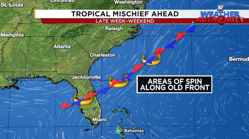
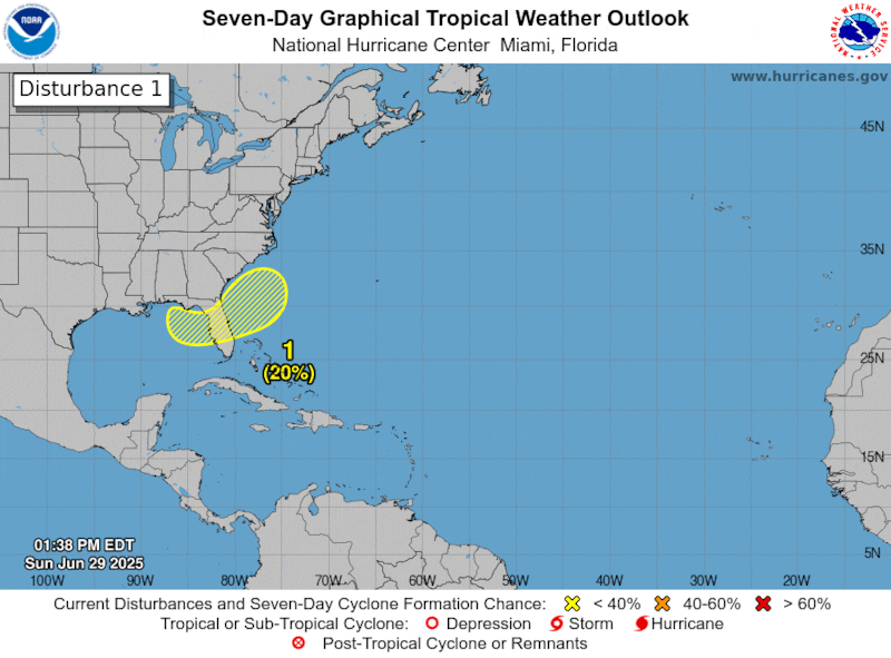
As we’ve detailed in newsletters this week, models were initially unclear as to whether the risk of development would be higher over the northeastern Gulf or over the Atlantic waters off the southeast coast, but beginning yesterday the trends shifted to the Atlantic and the National Hurricane Center in turn shifted its potential development zone eastward as well.
The changes to the forecast, which also delay development possibly into early next week, don’t appreciably change the outcome. For now, the primary threat will be areas of heavy rain heading into the Fourth of July and lingering through the holiday weekend for much of Florida, especially west-central Florida and the well-traveled I-4 corridor from Tampa to Orlando.

Models are still mostly ho-hum on development, suggesting weaker scenarios, with the possibility of a brief tropical depression or low-grade tropical storm either moving inland over the southeast U.S. or loitering just offshore into next week.
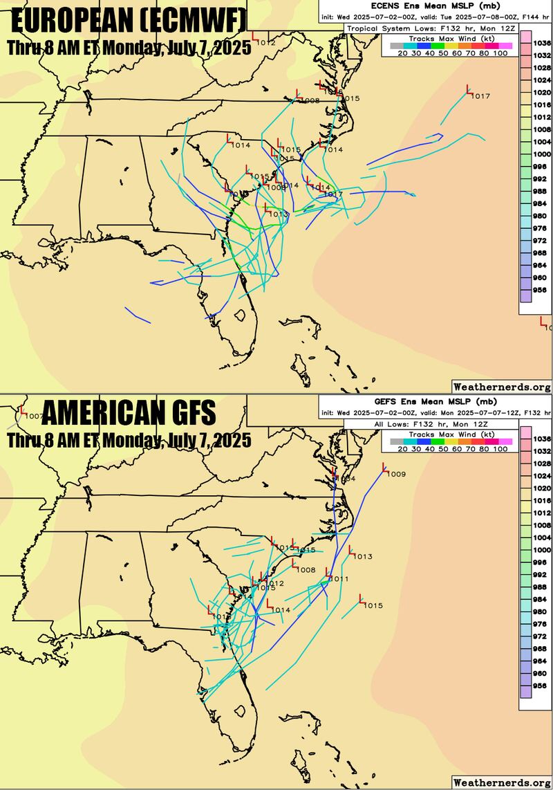
For now, the system may bring periods of disruptive weather to outdoor holiday plans with increased storminess and the possibility of widespread heavy rainfall in parts of Florida, but the risk of significant development remains low.
CLICK HERE to download the Local 10 Weather Authority’s 2025 hurricane survival guide.
Copyright 2025 by WPLG Local10.com - All rights reserved.
