
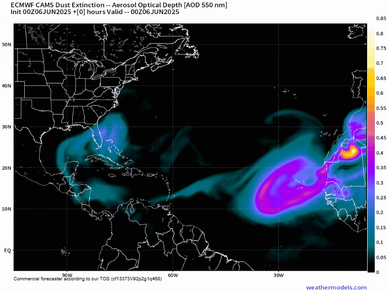
It’s been a dusty start to the 2025 hurricane season with the biggest Saharan dust outbreak of the year reaching the sands of South Florida this week from the soils of West Africa over 4,000 miles away.
The dust, most concentrated around 5,000 to 15,000 feet above the ground – or around the height you’re allowed to start using portable electronic devices on commercial flights, has tamped down on our rain chances in South Florida headed into the weekend. The suspended dust particulate is also helping to veil our usual blue skies, turning them a hazy milky white instead.
Saharan dust outbreaks – which are hoisted from the shores of west Africa every three to five days during the summer – typically peak in June and July and their arid presence during the early months of the hurricane season is a welcome sight for those living in the hurricane zone.

The warm, dusty air layer overhead can cap storminess and stifle tropical activity. Unfortunately for us, the Saharan dust usually diminishes right as the hurricane season ramps up in August and September. (Not a coincidence!)
Another massive dust plume incoming
It’ll take until early next week for South Florida to shake off its dust, which means widespread thunderstorms won’t be a problem through the weekend.
Another massive outbreak of Saharan dust is already on its way across the tropical Atlantic. Models forecast these dust reinforcements to reach the easternmost Caribbean islands and Puerto Rico to start next week. All the dust will continue to keep the tropical Atlantic quiet for the near term.
As we mentioned in Monday’s newsletter, by the middle of the month, storminess may be on the rise around Central America, including in the western Caribbean and southern Gulf. It’s too soon to know whether we’ll have any tropical trouble, but it’s something we’ll keep an eye on deeper into next week.
Copyright 2025 by WPLG Local10.com - All rights reserved.
