
Author’s note: The taxpayer-funded tools from NOAA I consulted to provide the forecast information and analyses in today’s newsletter include wind analyses from the University of Wisconsin’s Cooperative Institute for Meteorological Satellite Studies (CIMSS). CIMSS is just one of the dozens of weather and climate facilities slated for elimination in NOAA’s 2026 proposed budget.
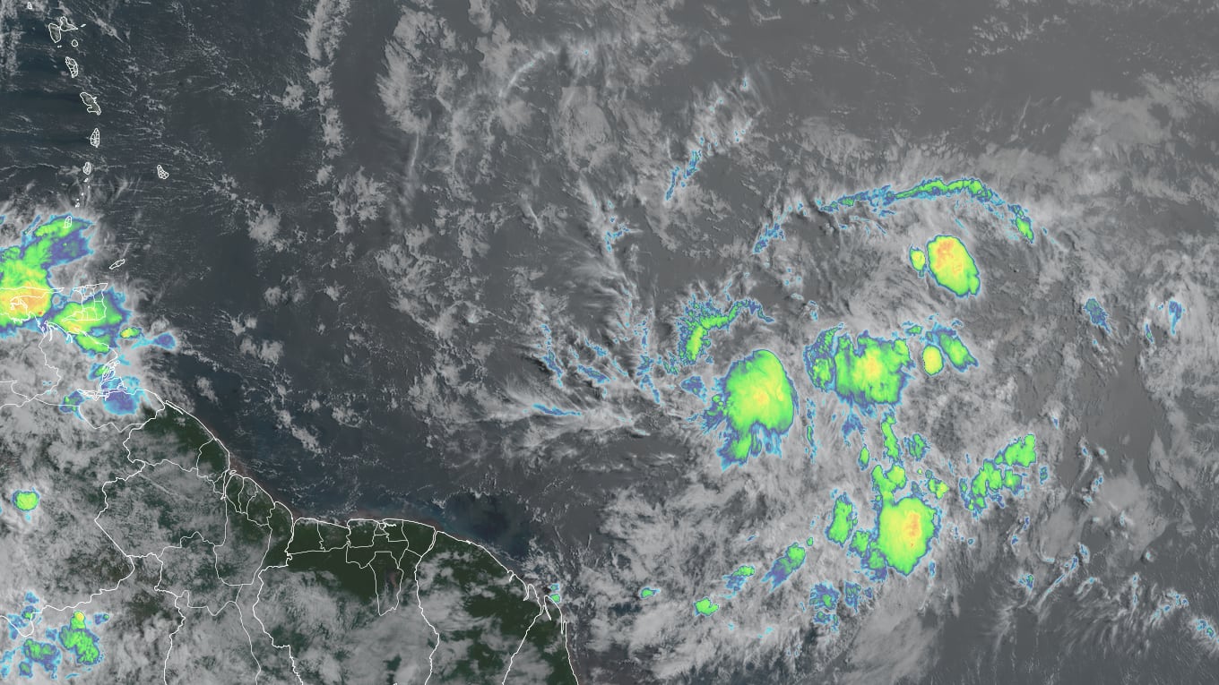
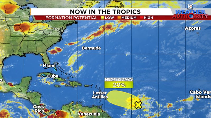
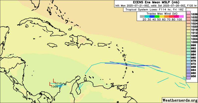
Late Friday, the National Hurricane Center tagged its first area of interest over the traditional Main Development Region or MDR of the Atlantic – the band of deep tropical waters east of the easternmost Caribbean islands – so far this hurricane season.
It’s an annual rite-of-passage for the Atlantic marking the transition into the more active part of the hurricane season, when long-lived hurricanes that have their origins off the coast of Africa – the notorious and eponymous Cabo Verde hurricane – become more commonplace.
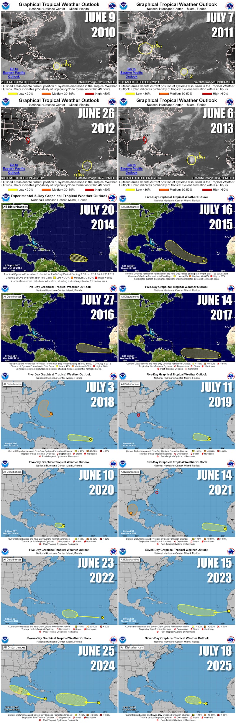
That shift this season was much later than most of the past 16 hurricane seasons, with only the 2014 and 2016 hurricane seasons not seeing their first MDR area of interest until this late in July.
As we’ve discussed in previous newsletters, the famed Cabo Verde part of the hurricane season officially kicks off in August, ramping up quickly, peaking in September, then winding down by mid-October.
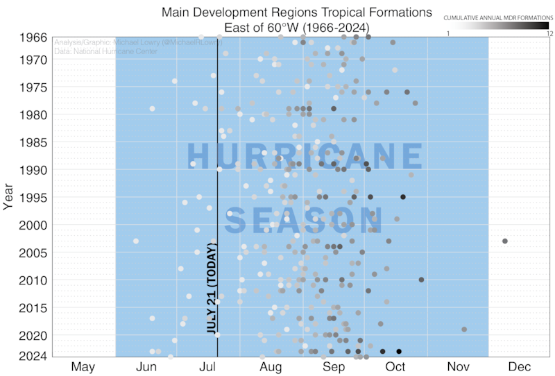
That’s because the first tropical system to form in the MDR east of the islands typically comes around the first week of August but in the satellite era (since 1966), it’s varied from as early as June 11th (2003) and as late as September 20th (1972).
Regardless, we’re square in the window to be watching for development farther out over the Atlantic where we find the only area of interest today.
Lackluster forecast ahead
Forecast models are decidedly uninspired on development with the tropical disturbance, especially once it reaches the Caribbean.
Though one of the more robust tropical waves we’ve seen so far this hurricane season, it’s traveling along the southwest side of a thick bed of Saharan dust and thunderstorm activity remains disorganized.
For the next day or two, the environment is somewhat conducive for slow organization but by Wednesday it’ll run into a wall of wind shear at the entrance of the eastern Caribbean which should immediately close the door on development for the rest of the week. Models are in agreement, with few scenarios showing a discernable low-pressure system west of the Lesser Antilles.
Other than increasing rain chances to the islands by mid-week, we don’t expect much out of this one.
Elsewhere across the Atlantic
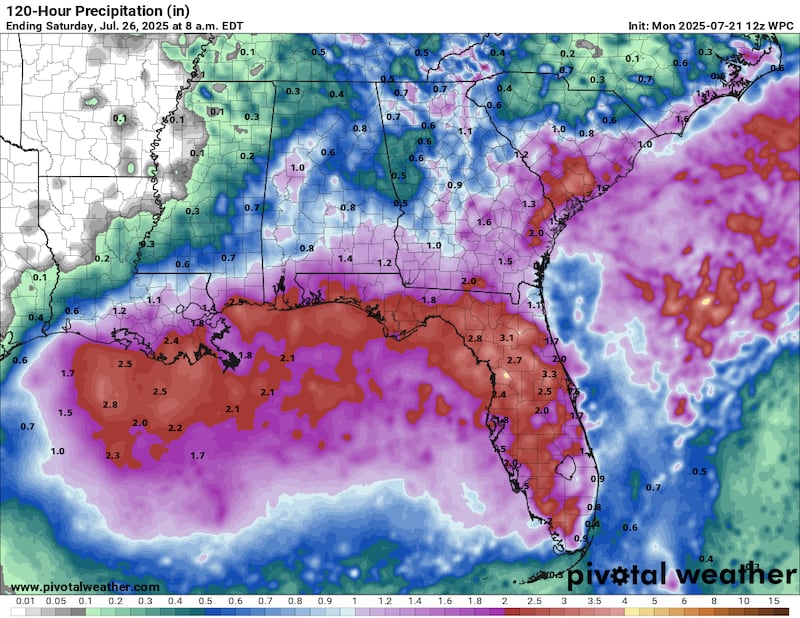
As we discussed on Friday, a small piece of Invest 93L that circled clockwise around a high-pressure dome anchored over Florida this weekend will find its way back over the northern Gulf this week. Re-development isn’t expected, though it will bring the chance for locally heavy rainfall again from Florida to the north-central Gulf Coast.
Otherwise, models are picking up on another tropical disturbance set to roll off Africa tomorrow. Like its western counterpart already over Atlantic waters, models aren’t too enthusiastic about its development odds, but I wouldn’t be surprised to see it introduced in a future outlooks if trends continue.

CLICK HERE to download the Local 10 Weather Authority’s 2025 hurricane survival guide.
Copyright 2025 by WPLG Local10.com - All rights reserved.
