
Author’s note: The taxpayer-funded tools from NOAA I consulted to provide the forecast information and analyses in today’s newsletter include wind analyses from the University of Wisconsin’s Cooperative Institute for Meteorological Satellite Studies (CIMSS). CIMSS is just one of over a dozen weather and climate facilities slated for elimination in NOAA’s 2026 proposed budget.
The tropics should stay mostly quiet into the waning days of July.
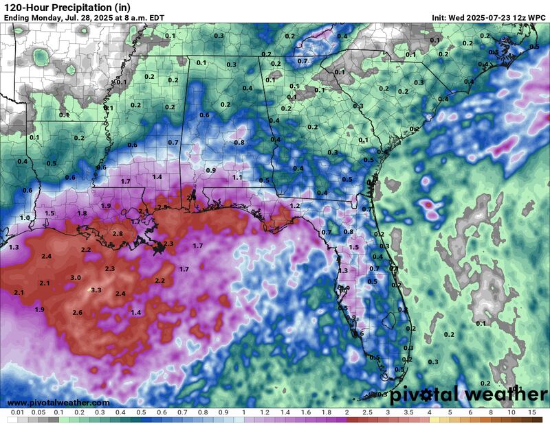
As we discussed in the newsletter last Friday and again on Monday, a disorganized area of low pressure – largely an offshoot of a stalled cold front with some embedded scraps of Invest 93L that scraped the Gulf Coast last week – is expected to move through north Florida today and into the northern Gulf by tomorrow.
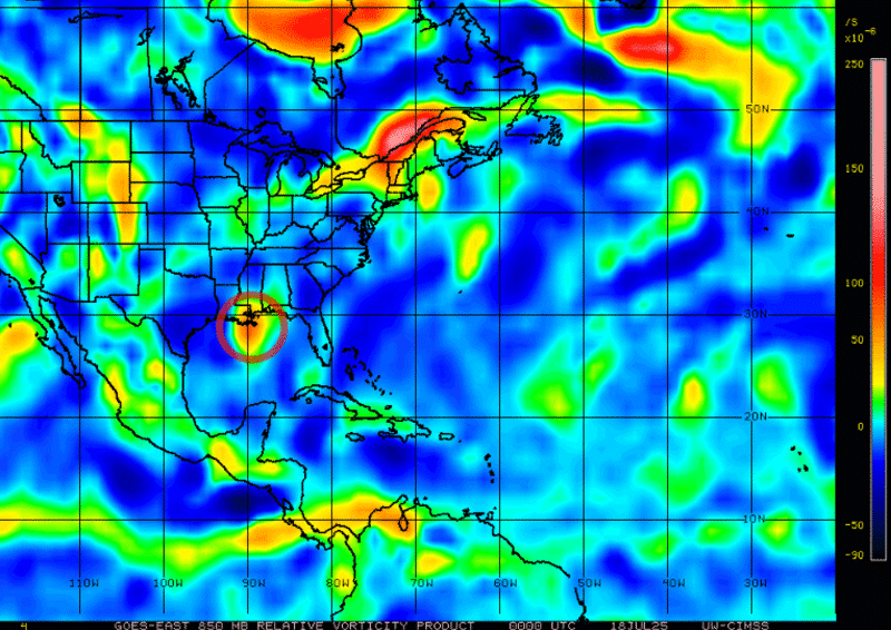
While the National Hurricane Center added the area to its tropical outlook last night, development odds are very low, and it’s unlikely we see anything more than a multi-day rainmaker for the northern Gulf out of it.

Unlike 93L last week, which caused concerns for considerable flash flooding across parts of Louisiana, the rain totals this week look largely manageable and the National Weather Service is indicating only a marginal risk (level 1 of 4) of isolated flash flooding with the Gulf system.
Environmental conditions will be working against significant development, with very hostile wind shear following it. Like 93L last week, it will also be contending with land impediments as it scrapes the coast. We’ll of course continue to monitor its progress, but it doesn’t pose a serious threat for now.
Elsewhere across the Atlantic
The tropical wave that moved off Africa earlier this week, which we covered in earlier newsletters, is rolling westward over the eastern tropical Atlantic.
Though models are lukewarm on any development out of it, the tropical wave is one of the more robust disturbances we’ve seen off Africa this season and a reminder that the busy part of the hurricane season is fast approaching.
CLICK HERE to download the Local 10 Weather Authority’s 2025 hurricane survival guide.
Copyright 2025 by WPLG Local10.com - All rights reserved.
