
Author’s note: The taxpayer-funded tools from NOAA I consulted to provide the forecast information and analyses in today’s newsletter include satellite data from the Cooperative Institute for Research in the Atmosphere (CIRA) and wind analyses from the University of Wisconsin’s Cooperative Institute for Meteorological Satellite Studies (CIMSS). Both CIRA and CIMSS area slated for elimination in NOAA’s 2026 proposed budget.
As we discussed in Friday’s newsletter, the Atlantic is beginning its pivot into the traditionally busiest 6-week stretch of the hurricane season. The disturbances rolling off Africa – tropical waves so named because the ripple in their low-level winds resemble crested ocean waves – are healthier and forecast models are advertising an uptick in activity over the next few weeks.
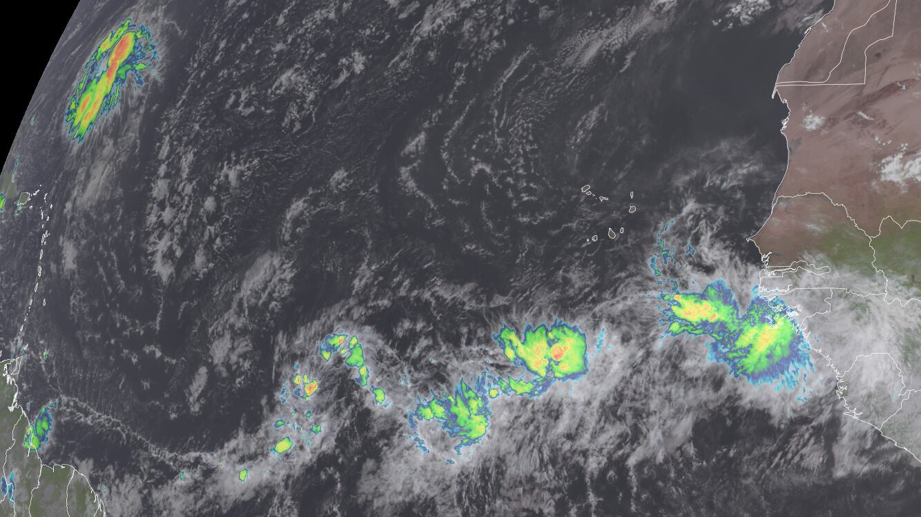
Today, we can quickly spot two active tropical waves on the morning satellite.

The first disturbance north of the eastern Caribbean is the northern branch of a tropical wave that we first mentioned in this newsletter last Tuesday as it emerged off Africa. Despite its spicy appearance, we’re not expecting any development out of it.
Another robust tropical wave is rolling off Africa today. We discussed this one in the newsletter last Friday and models do indicate some slow development possible in the week ahead. The new AI models have been overzealous with this one, however, and the trend overall since Friday has been away from significant organization.
We’ll of course continue to follow its progress this week, especially as it approaches the easternmost Caribbean islands by the end of the work week and into the weekend, but for the near term it doesn’t pose a serious development threat.
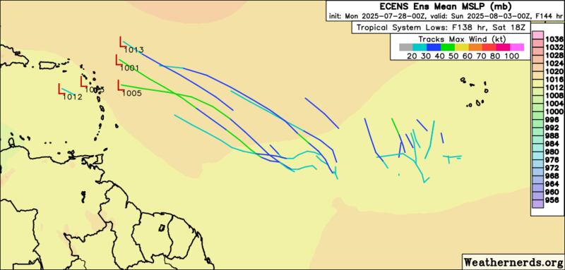
It’s worth noting that models do show some possible low-pressure mischief off the U.S. East Coast this weekend along a cold front giving a splash of relief to the scorching southeastern U.S. (north of Florida, of course!). It’s not a big concern for now, but something we’ll monitor as the weekend draws near.
A storm-friendly Atlantic to start August
We discussed last Tuesday all the changes ahead that will make the Atlantic more conducive to storminess in the weeks ahead. We continue to see this pattern change in the longer-range models, including a significant slackening of upper-level winds through the heart of the tropical Atlantic and Caribbean as we approach the middle part of the month.
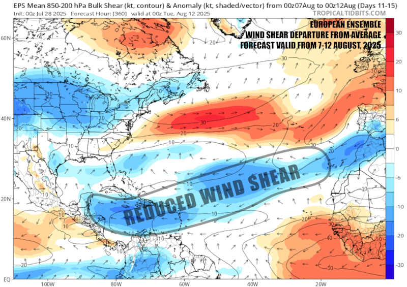
The verdict’s out on whether would-be storms will take advantage of these less hostile conditions to development, but given the time of year, it means we’ll want to be extra vigilant in the weeks ahead.
CLICK HERE to download the Local 10 Weather Authority’s 2025 hurricane survival guide.
Copyright 2025 by WPLG Local10.com - All rights reserved.
