
Saharan dust plumes heaved through the Atlantic from the deserts of North Africa each summer – providing rich nutrients for the soils of the Amazon while helping to curb early season hurricane activity – have been largely a no-show so far.
July, when dust outbreaks typically peak across the Atlantic, recorded the lowest concentration of Saharan dust in the satellite record (back to 2002).

Although tropical waves – the disturbances from Africa primarily responsible for transporting dust across the Atlantic – started the season weaker than usual, there’s been an uptick in overall wave activity and robustness in recent weeks. Nevertheless, the dust has stayed stubbornly low.
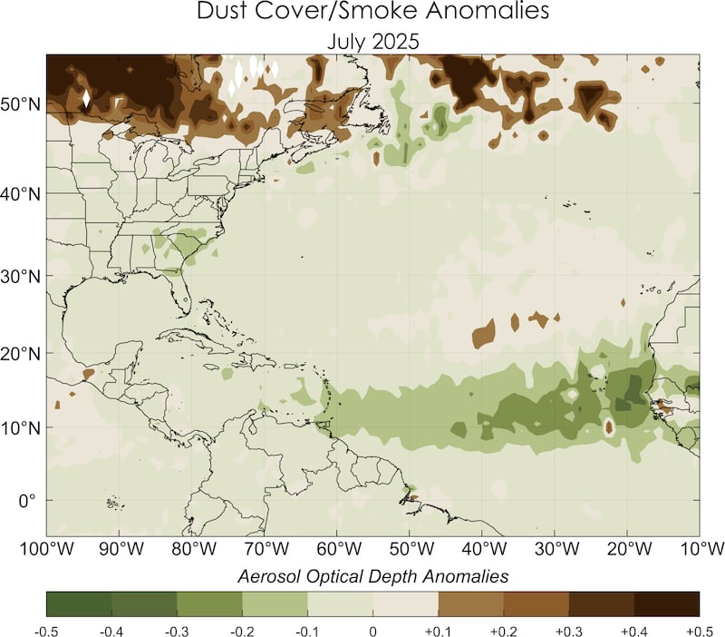
Dust concentrations to end July were running as low as we’ve seen them in late September, so with the exception of the occasional outbreak, don’t expect dust to be a big player this hurricane season.
Tropical Atlantic gearing up
As we’ve detailed in recent newsletters, the first few weeks of August should show a more active Atlantic, though it’s still to be seen how much the basin will capitalize on the more conducive conditions.
The organized storminess promoted by the Madden-Julian Oscillation or MJO is focused on the Pacific this week, with a notable tropical cyclone outbreak across the central Pacific that’s slowly bleeding into the eastern Pacific. This pulse of storminess will find its way into the Atlantic starting next week.
For now, despite some healthy tropical waves dotting the Atlantic, we don’t see any organized development threats to close out July.

CLICK HERE to download the Local 10 Weather Authority’s 2025 hurricane survival guide.
Copyright 2025 by WPLG Local10.com - All rights reserved.
