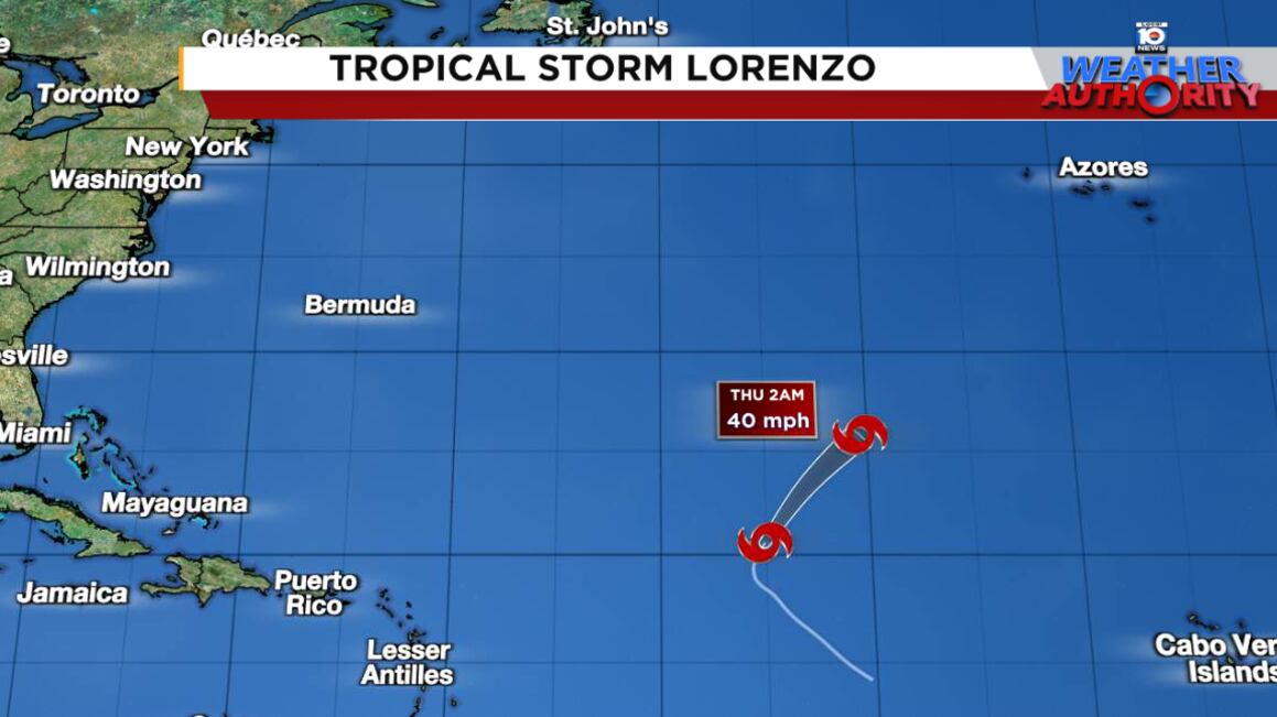
Despite earlier forecasts showing Tropical Storm Lorenzo hanging around into the weekend, the unfriendly central Atlantic of mid October has done a number on it, and it’s no longer expected to survive the work week.
As we’ve discussed in previous newsletters, the last two named storms in the Atlantic – Karen and Lorenzo – formed in areas considered out of bounds for development for the time of year. Bouts of shear and dry air become increasingly common over the Atlantic once October and November roll around as fewer and fewer tropical waves emerge off Africa, making development increasingly less common.
Of the 280 hurricanes to be recorded in October, November or December in the Atlantic, fewer than 1 in 20 (less than 5%) has moved through the deep tropical belt east of the islands.

Lorenzo is forecast to dissipate by tomorrow over the open Atlantic and poses no threat to land.
Next development window probably not until later next week
Overall, the Atlantic looks to be simmering down through early next week.
As we’ve discussed in previous newsletters, a vigorous late-season tropical wave moving south of the Cabo Verde Islands off Africa today is forecast to enter the Caribbean early next week and could slowly develop once it reaches the western Caribbean later next week.
For now, it’s just something to watch. The development signal isn’t particularly strong, but for 10-plus days out, it’s persistent enough to warrant a mention.

Unlike Lorenzo’s location this week in the central Atlantic, the western Caribbean is a breeding ground for tropical storms and hurricanes in October and November, so climatology favors the area.
Forecast models also show a pocket of lighter upper-level winds and reduced wind shear east of Honduras, which would promote development.

Whether it actually develops or gets buried in Central America is to be seen, but we’ll keep an eye on the model trends. So far, they’ve been steady but we also haven’t seen any significant uptick in the ensembles either, which is encouraging.
Bottom line: check back periodically as you would normally, but it’s nothing for us to worry about for now.
Copyright 2025 by WPLG Local10.com - All rights reserved.