
Despite a blazing Gulf of Mexico – the warmest on record at any point in any year by a wide margin – the tropics will stay mostly sluggish closer to home this week.
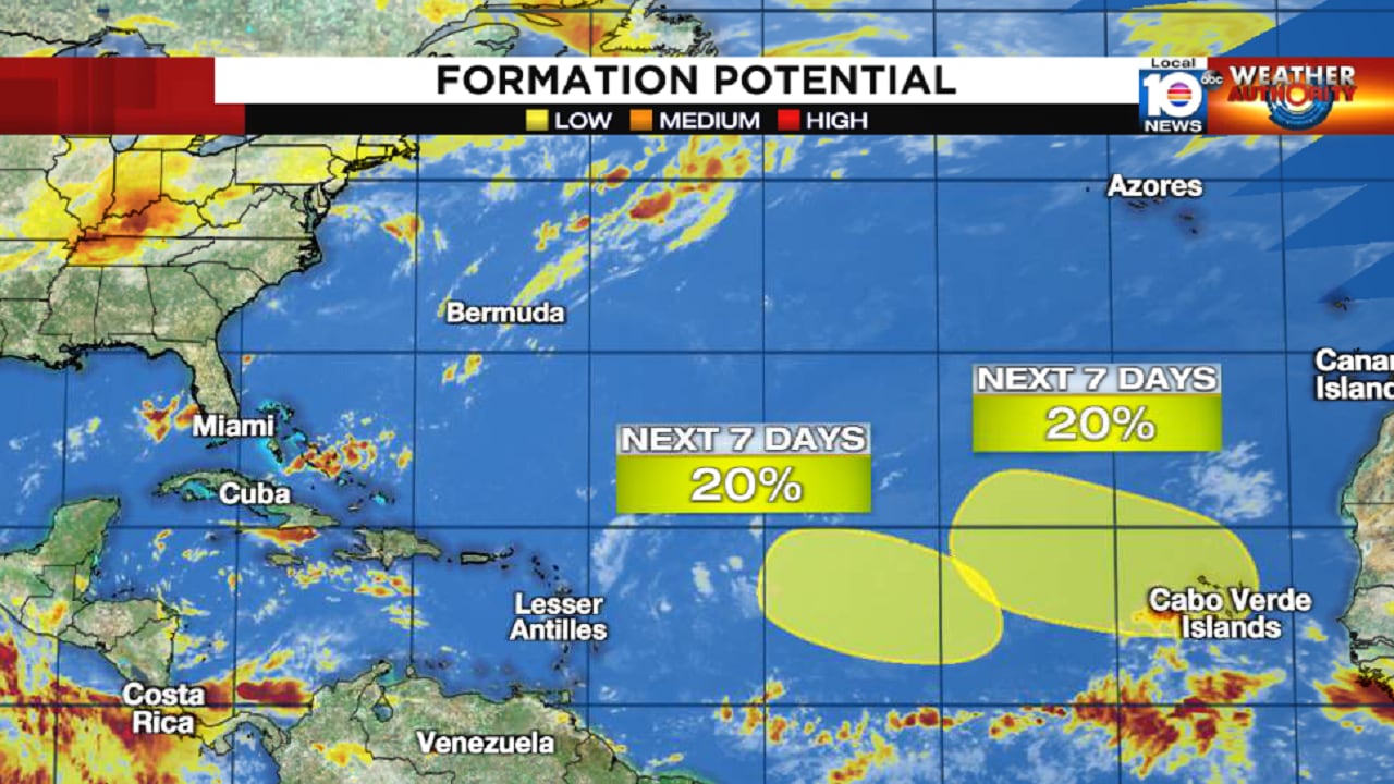
Instead, we’ll be following two disturbances farther out in the eastern and central Atlantic for some slow development. Though the National Hurricane Center gives each area low odds for formation in the days ahead, we’ll be watching in particular the easternmost disturbance as a strong tropical wave rolls off Africa by mid-week.
Both disturbances are associated with an active monsoon trough – a long strip of storminess and background spin that extends from Africa southwestward toward South America.
As tropical waves move off Africa and into the monsoon trough, they can sometimes slowly organize, supported by the more conducive environment along this tropical umbilical cord. While the monsoon trough can support development, it can also stifle it, stretching out low-pressure areas and not allowing thunderstorms to quickly fuse together to build the heat engine of a hurricane.
This week, models suggest a monsoon trough that may be more limiting to development. Our ensemble models – models run 101 different times every 6 hours with slight variations in their starting conditions – show a number of possible weak low pressure areas in the vicinity of the monsoon trough.

With no one area dominating, this tells us the overall environment may be broadly conducive, but we shouldn’t expect any fast formers.
We’ll watch to see if one of these areas can take shape and consolidate, but for now, anything that develops will be slow to occur. The development signal is stronger with the easternmost disturbance, so we’ll keep a closer eye on development trends as the precursor wave emerges off Africa in the coming days.
Copyright 2023 by WPLG Local10.com - All rights reserved.
