KEY WEST, Fla. — Flooding remained a concern for residents on Wednesday in some areas of the Florida Keys as Hurricane Ian made landfall in southwestern Florida’s Cayo Costa as a Category 4 storm.
Storm surge flooded areas of Key West, where the airport and the port closed. Monroe County Public Schools also closed. Officials turned Key West High School into a shelter for 118 people.
Josh Martin, a Conch Republic resident, who is used to stormy weather, said Ian’s effects overnight felt stronger than usual. Ian, he said, was too close for comfort.
“It was picking up a little more than I thought ... We checked the storm tracker to see how close we were to the eye and we were like, ‘It is starting to look pretty nasty!’”
The sky was gray and there was flooding and debris in areas that are usually full of tourists. The U.S. Postal Service announced a temporary suspension of services.
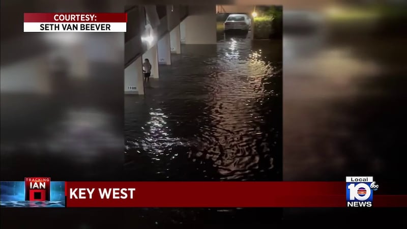
There were drivers who were stranded in flooded streets Tuesday, but on Wednesday some residents felt safe enough to remove their shutters from their windows.
Steve Dykstra, a tourist who was exploring Duval Street, the heart of the island city, said he was concerned about the damage that he was going to see. There wasn’t much.
“It was really wild out there. The trees were just swinging,” Dykstra said about Tuesday night.
Several transformers blew up overnight. Officials reported there were thousands of customers without power in the Lower Keys and asked residents to stay away from downed or low-hanging powerlines.
FLOOD THREAT CONTINUES
The Key West Police Department released a warning: “Standing water is hazardous. Downed power lines and contaminants could be life-threatening. Please avoid walking in the water.”
Meteorologists warned that storm surge damage to ground-story buildings, marinas, docks, boardwalks, and piers is still possible.
A storm surge warning — to indicate a danger of life-threatening inundation of up to four feet — was in effect from Key West to Big Pine Key.
With the King Tide, meteorologists warned the highest storm surge in the Middle Keys will be on Wednesday afternoon, and in the Upper Keys’ bayside areas on Thursday and Friday.
The National Weather Service Key West warned tornadoes and an additional four inches of rain were possible through Thursday.
Businesses and residents of homes in the lower elevation areas of the middle and upper Florida Keys, from Marathon to Ocean Reef, are at risk for up to three feet of storm surge.
The Dry Tortugas National Park was no longer under a hurricane warning
Florida Keys watches and warnings
- Storm surge and tropical storm warnings are in effect for the Lower Keys
- Tropical storm warning and storm surge watch are in effect for the Middle Keys and the Upper Keys
Interactive map
Also in Key West: Key West building fire during storm destroys businesses, apartments
Torres contributed to this report from Miami.
Copyright 2022 by WPLG Local10.com - All rights reserved.

