
It’s been 219 days since we’ve seen a tropical depression or named storm anywhere in the Atlantic, but it looks like that streak will end on Tuesday.
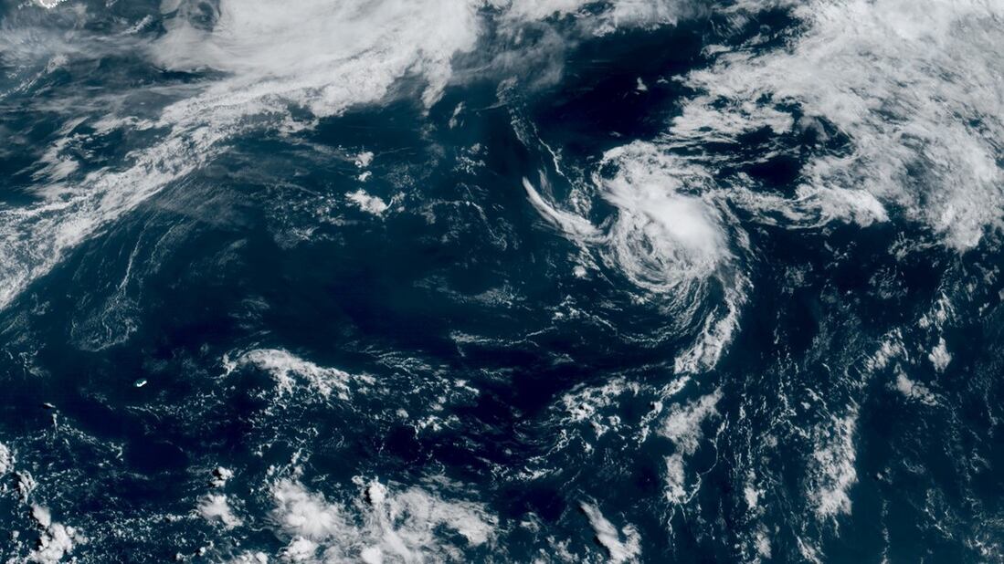
An innocuous area of low pressure – designated Invest 90L by the National Hurricane Center – over the open Atlantic some 900 miles east-northeast of Bermuda is expected to become Tropical Storm Andrea later on Tuesday, the first named storm of the 2025 Atlantic hurricane season.

The small disturbance was spawned from a stalled cold front draped over the north-central Atlantic over the weekend.
On Sunday, NHC gave the small low-pressure system very low (10%) odds of developing but less than 24 hours later they had ratcheted up development odds to 70%, with 90L exhibiting most characteristics of a tropical depression.

With hostile wind shear nearby, thunderstorms had trouble persisting over 90L’s center yesterday, getting blown away after each huff and puff.
As a result, NHC lowered development odds Monday evening to 40% and kept development odds near 50/50 into Tuesday morning.
But shortly after they issued their standard 8 a.m. ET tropical weather outlook on Tuesday, forecasters sent a special outlook, indicating the increase in thunderstorm activity would likely be enough to classify 90L a full-fledged tropical cyclone.
Latest satellite-derived wind estimates indicate 90L already has winds of tropical storm strength, so when it gets the upgrade it will bypass tropical depression status and go straight to Tropical Storm Andrea.
Andrea forming far out of bounds
It’s been a quick but tumultuous development rollercoaster for the tenacious low-pressure system that will soon be Andrea, one that’s been propped up by its fortuitous position over some of the most abnormally warm waters of the entire North Atlantic.

While water temperatures are only in the mid to upper 70s near future Andrea – below the usual 80-plus degree Fahrenheit waters we’d expect for tropical formation – the relative warmth compared to what’s typical for the time of year combined with unusually cold temperatures high up in the atmosphere have been a boon for development odds.
It’s worth noting that no tropical depression, tropical storm, or hurricane has formed as far north and east as soon-to-be Andrea since recordkeeping began.

Regardless of development, the system will get gobbled up by blistering wind shear by Wednesday and is no threat to land.
CLICK HERE to download the Local 10 Weather Authority’s 2025 hurricane survival guide.
Copyright 2025 by WPLG Local10.com - All rights reserved.
