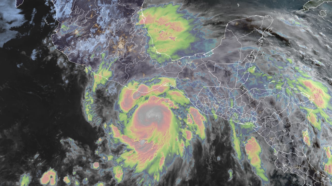
Erick became the second hurricane of the eastern Pacific hurricane season early Wednesday and is forecast to rapidly strengthen before striking southwest Mexico on Thursday as a dangerous Category 2 or Category 3 hurricane.

If Erick hits Mexico as forecast, it would be the strongest pre-July hurricane on record to strike the country.

Over the past 75 years, 16 hurricanes have made landfall in Mexico before July, with only three striking at Category 2 intensity, the last time being in late May 2022 when Hurricane Agatha struck the small coastal town of Puerto Ángel, also under a hurricane warning for Erick. No Category 3 or stronger hurricane landfall has been recorded in Mexico before July.
The sharp angle of approach Erick is taking to the coastline makes the exact landfall spot along Mexico’s coast more uncertain than usual and a wide stretch of Mexico’s Pacific coast from Acapulco to Puerto Ángel – nearly 250 miles east of Acapulco – is under a hurricane warning.
Intensity guidance gives a 90% chance of Erick undergoing rapid intensification – an increase in its maximum winds by at least 35 mph over the next 24 hours – before landfall Thursday. Although forecast to peak as a high-end Category 2 hurricane with 110 mph winds, Erick could easily come ashore as a Category 3 hurricane with just a small bump in its winds.
In addition to destructive winds, life-threatening flooding will also be a problem, especially across the Mexican states of Oaxaca and Guerrero, where up to 20 inches of rain is forecast.
Atlantic snoozing along
While the eastern Pacific runs about a month ahead of schedule with its activity, the Atlantic is on track for a typical to even slow start. Models are muted on any development chances for the basin into at least the middle part of next week.

CLICK HERE to download the Local 10 Weather Authority’s 2025 hurricane survival guide.
Copyright 2025 by WPLG Local10.com - All rights reserved.
