
The Atlantic’s making up for a slow start, with Dexter alone doubling the paltry activity of the past two months, and more storms on the horizon.
The good news is that the three systems tagged in the National Hurricane Center’s outlook this morning shouldn’t be a threat to any land areas, but a tropical wave set to emerge off Africa this weekend will deserve our attention next week.
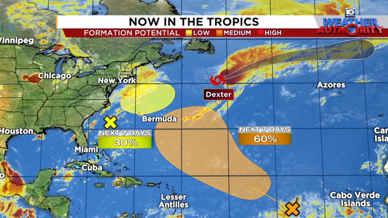
System off southeast stays offshore
Earlier in the week, forecast models suggested another low-pressure area spawned from a stalled front off the southeast U.S. could loop back toward the Carolinas and bring periods of heavy rain by tomorrow into the weekend. Models have shifted over the past day or two, and now keep the system offshore, with the heaviest rains over water.
It’s to be seen if the low-pressure area can gather enough steam to become our next named storm (Erin), but the development window looks to be this weekend into very early next week. Either way, it’ll stay offshore and is no threat to land.
Invest 96L could develop but curling out to sea
The tropical wave we’ve been tracking through the central Atlantic was designated Invest 96L by the National Hurricane Center on Wednesday.
Designating a system a so-called “Invest” allows NHC to run a special suite of models, including intensity guidance, for a system. The data we gather during the invest stage is helpful in understanding the environment ahead and whether a storm or hurricane might develop.
For Invest 96L, the environment ahead looks generally conducive to development, and most of the early intensity guidance is fairly bullish on it eventually becoming a named storm come early next week.

Forecast models are in good agreement with curling 96L or what comes of it northward next week and eventually out to sea. We’ll need to monitor where the bend happens, as a wider turn could bring the system closer to Bermuda.
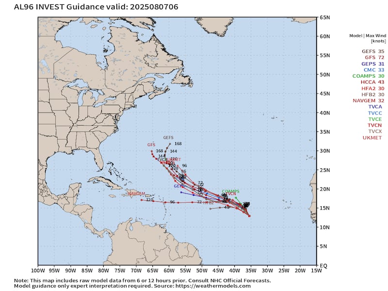
At the moment, we don’t anticipate 96L will be a threat to any land areas in the upcoming week.
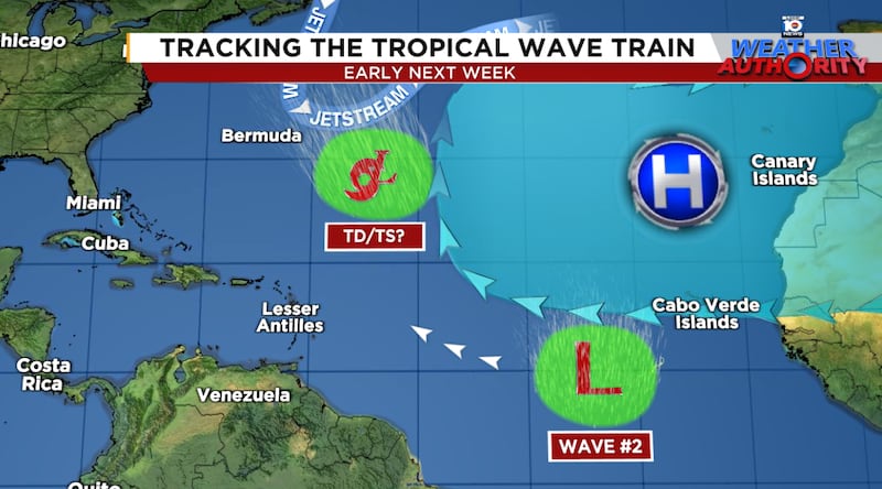
Keeping our eye on the next wave
Another tropical wave is set to roll off Africa by this weekend and we continue to see a robust signal in longer-range models of this one developing next week.
The system will head generally west or west-northward in the direction of the Caribbean islands for late next week. Overall, the environment in the Caribbean and western Atlantic appears ripe next week, so we’ll want to keep an eye on this one, especially if it manages to sneak farther west.

It’s far too early to speculate on what may ultimately come of this wave and there’s no need to bother worrying over 15-day forecasts with zero skill that change wildly with every new model run. It’s August and on almost any day of August you’ll find a fantasyland (past 7 or 10 days) model run with a U.S. hurricane strike. Anyone sharing these single-run forecasts 10 or 15 days out isn’t credible. At best, they’re misinformed. At worst, they’re gratuitously stoking unnecessary fear for profit or likes.
It’s especially important over the next few months to rely on trusted, official sources of information for both your sanity and safety. The hurricane hype and fearmongering get really noisy this time of year. If we see a serious, credible hurricane threat, you’ll be sure to hear about it here first.
Dexter transitioning to a powerful extratropical storm
Dexter lasted longer as a named storm than all three named storms that preceded it and, in the process, doubled the paltry ACE (Accumulated Cyclone Energy) score for the hurricane season. Atlantic tropical activity remains well below average for the season, but we should see those numbers rise in the coming week.

Dexter is quickly shedding its tropical shell and is well on its way to becoming a powerful extratropical storm as it races eastward across the open north Atlantic.
CLICK HERE to download the Local 10 Weather Authority’s 2025 hurricane survival guide.
Copyright 2025 by WPLG Local10.com - All rights reserved.
