
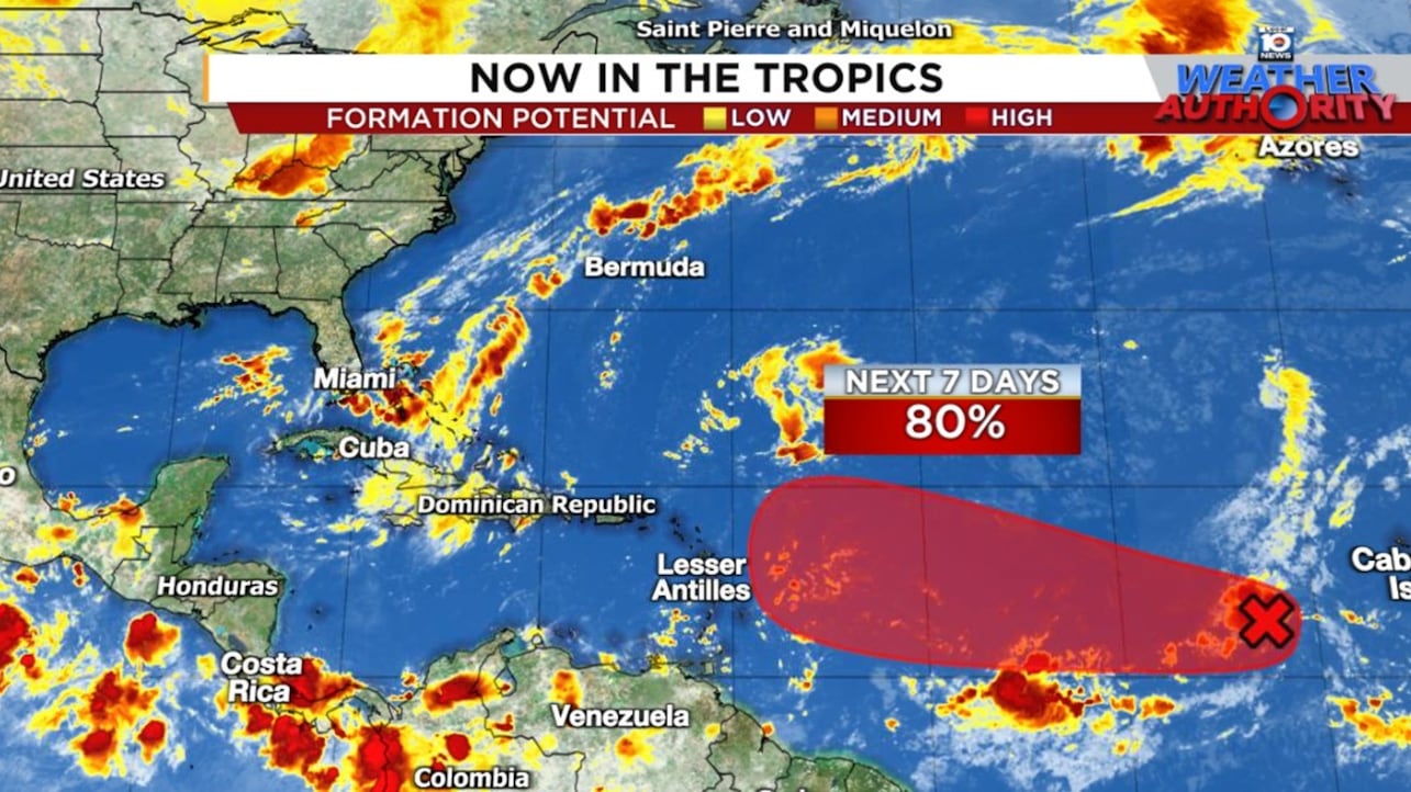
A tropical wave over the eastern Atlantic – designated Invest 91L by the National Hurricane Center early Thursday – is becoming better organized and will likely develop into a tropical depression or named storm by this weekend as it moves slowly west.
Although it’s still about a week out from reaching the area around the eastern Caribbean, including the islands that border it, interests in these areas – including the Lesser Antilles, Puerto Rico, and the U.S. Virgin Islands – should monitor the forecast and progress of 91L this weekend into early next week.
Watching to see where it comes together
Until the disturbance becomes better defined – with its broad, elongated area of spin and disorganized storminess turning more circular, concentrated, and organized – forecast models are going to struggle nailing down its future track and strength.
It’s in the process of doing this today, but it’ll happen gradually, not necessarily overnight. So we need to give this another few days to shake out before we know whether it will be a bona fide threat to the islands.
The model camps have held steady in their general trajectories.
The American GFS favors a track just north of the eastern Caribbean, the European model is advertising a path into the Lesser Antilles and Leeward Islands, and Google’s machine learning-based DeepMind model remains on the southern side of the guidance, suggesting a path directly into the eastern Caribbean by late next week.

Early intensity guidance suggests this should be a gradual strengthening process into early next week, although a southerly track would favor faster organization as models indicate less hostile wind shear in the belt of waters south of the islands.
Far too soon speculate on the mainland U.S.
Our ability to forecast these systems with any amount of skill and confidence is limited to about 5 to 7 days out, and that’s after we have a defined circulation, something we don’t have just yet.
This is a slow mover, and it’s still a week away from landing in the vicinity of the islands.
To make it all the way to the mainland U.S. would be probably another two weeks, and of course we have no way of knowing at this stage if that’s even a credible possibility.
You’ll probably see very long-range computer model simulations (beyond 7 or 10 days) shared on social media in the coming days that suggest a major hurricane strike on the U.S.
These are what I like to call fantasyland scenarios – imaginative and often scary depictions inflamed by chaos theory – and unfortunately used irresponsibly to stoke fear and promote likes and engagement.
It isn’t that they can’t happen (even a broke clock is right twice a day!), but they’re usually extreme outliers when compared to their more credible ensembles.
Both the 360-hour (15-day) so-called deterministic run (single track or operational run) of the American GFS and European models from overnight are good examples of this. They both depict a major hurricane near or along the southeast U.S., but virtually none of their ensemble members show this.

As we discussed in Wednesday’s newsletter, in general a persistent dip in the jet stream over the eastern U.S. would suggest a turn toward the north as the system moves into the western Atlantic.
Most models depict this scenario in the long-term, but where the system is located at the time and how strong it becomes will determine how gradual or sharp of a turn it makes.

Check back periodically, as you would during September, but it’s too early for us on the mainland to be overly concerned about it.
CLICK HERE to download the Local 10 Weather Authority’s 2025 hurricane survival guide.
Copyright 2025 by WPLG Local10.com - All rights reserved.
