
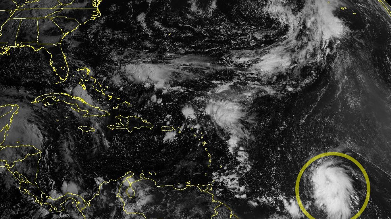
A strong tropical disturbance churning through the central Atlantic – designated Invest 95L – continues to organize and is on the cusp of becoming a tropical depression or named storm. The next name on the list is Jerry.

Forecast models indicate soon-to-be Jerry will strengthen over the next few days and could be a hurricane by the time it makes its closest pass to the Leeward Islands in the northern Lesser Antilles on Thursday and Friday.
Since Monday, some model camps have trended back toward the islands with a precariously close pass. Google’s DeepMind AI-based hurricane model in particular – a strong performer so far this season – has trended noticeably south over the past 24 hours, putting places like Guadeloupe, Antigua and Barbuda in play for possible direct impacts later this week.

It’s worth noting, however, that most models, including the consensus, still steer the system north of the islands, but there’s more than enough wiggle room that interests in the Leeward Islands will want to follow the forecasts closely.

Puerto Rico and the U.S. Virgin Islands could see periphery effects, including trailing showers or squalls, as the strengthening system passes to their north and east on Friday into the weekend.
The intensity forecast is tricky and guidance continues to give wide bookends – from a tropical storm to a major (Category 3 or stronger) hurricane in the days ahead.

The consensus supports strengthening to a hurricane by Thursday or Friday as it nears its closest pass to the islands.
Jerry will not be a problem for the U.S. as a strong “cold” front diving all the way through South Florida (not exactly cold for us, but at least a shot of somewhat cooler, drier air) and into the western Atlantic kicks it out to sea.

Coastal storm in the works for next week
As we’ve discussed in newsletters in past seasons, nearby tropical systems can often be a catalyst for dragging the first big cold front through South Florida. The first major South Florida fall frontal passage is a rite-of-passage, not only signaling a transition from the summer rainy season to a more pleasant dry season locally, but also an end in sight to the hurricane season.
The strong low pressure system responsible for what looks to be South Florida’s first clean fall frontal passage this weekend will begin as a non-tropical coastal storm off the Carolinas Saturday into Sunday.

If the system lingers off the coast and along the still-warm Gulf Stream waters, it could gradually acquire some tropical characteristics by early next week.
We’re still 5 to 7 days out from the coastal storm taking shape, so we’ll have some time to iron out the details. If the coastal storm does eventually transition into a subtropical storm, more likely than not it’ll resemble a nor’easter than a full-fledged tropical system, with a wide area of strong onshore winds that could bring repeated rounds of wind-whipped rains and coastal flooding from the Carolinas to the Mid-Atlantic.
Copyright 2025 by WPLG Local10.com - All rights reserved.
