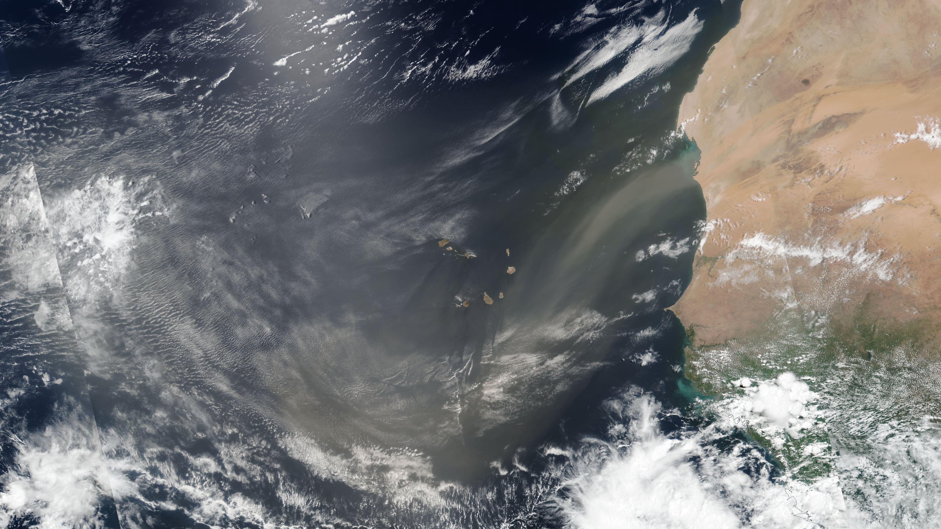
It’s the time of year giant plumes of dust heaved off the African continent from the Sahara Desert travel thousands of miles across the Atlantic, sprinkling down on the shoreline sands of Florida and the U.S. Gulf Coast.
The dust not only affects our skies when it arrives – dulling skies in the daytime with a milky, rust-like haze while sharpening sunsets with vibrant palettes – but also our weather, tamping down the odds of typical afternoon thunderstorms and often degrading air quality.

For us in South Florida, the biggest push of Saharan dust since the start of June will arrive over the next few days and hang around into early next week, suppressing rain chances and raising the summer heat risk, with feels-like temperatures approaching 105 degrees.
How is the dust shaping up across the Atlantic?
But across the wider tropical Atlantic, where continent-sized clouds of Saharan dust can act like a thorn in the side of would-be hurricanes, the dust has been running well below average heading into what’s typically the peak weeks of the Saharan dust season. Since the start of May, Saharan dust concentrations across the tropical North Atlantic have been the third lowest on record (behind only 2023 and 2019).

The dust – more specifically known as the Saharan Air Layer or SAL – is one of the factors that keeps tropical activity low in the early months of the hurricane season. When the SAL is strong, it not only helps to extinguish organized thunderstorms through heaping helpings of dry, dusty air, but the base of the Saharan dust plume increases wind shear that doubles down against hurricane development.
Saharan dust season usually slacks off very quickly in August, so it becomes less of an overall player by the peak months of the hurricane season. Thankfully, this season, we have an unusually cool Atlantic and much stronger-than-average wind shear courtesy of a burgeoning El Niño to pick up the slack and help deter early-season tropical mischief.
It’s worth monitoring the progress of the Saharan dust during the early months of the hurricane season, as lower dust concentrations over the tropical Atlantic can portend weaker tropical disturbances known as African Easterly Waves or a weaker jet of winds over western Africa (the African Easterly Jet or AEJ) that can affect tropical seedlings later in the season.
For now, the current round of dust and belt of blistering wind shear over the tropical Atlantic will shut down organized activity at least into the latter part of next week.
Copyright 2026 by WPLG Local10.com - All rights reserved.
