
With one named storm taking its final bow today, the Atlantic should close out August on a quiet note.

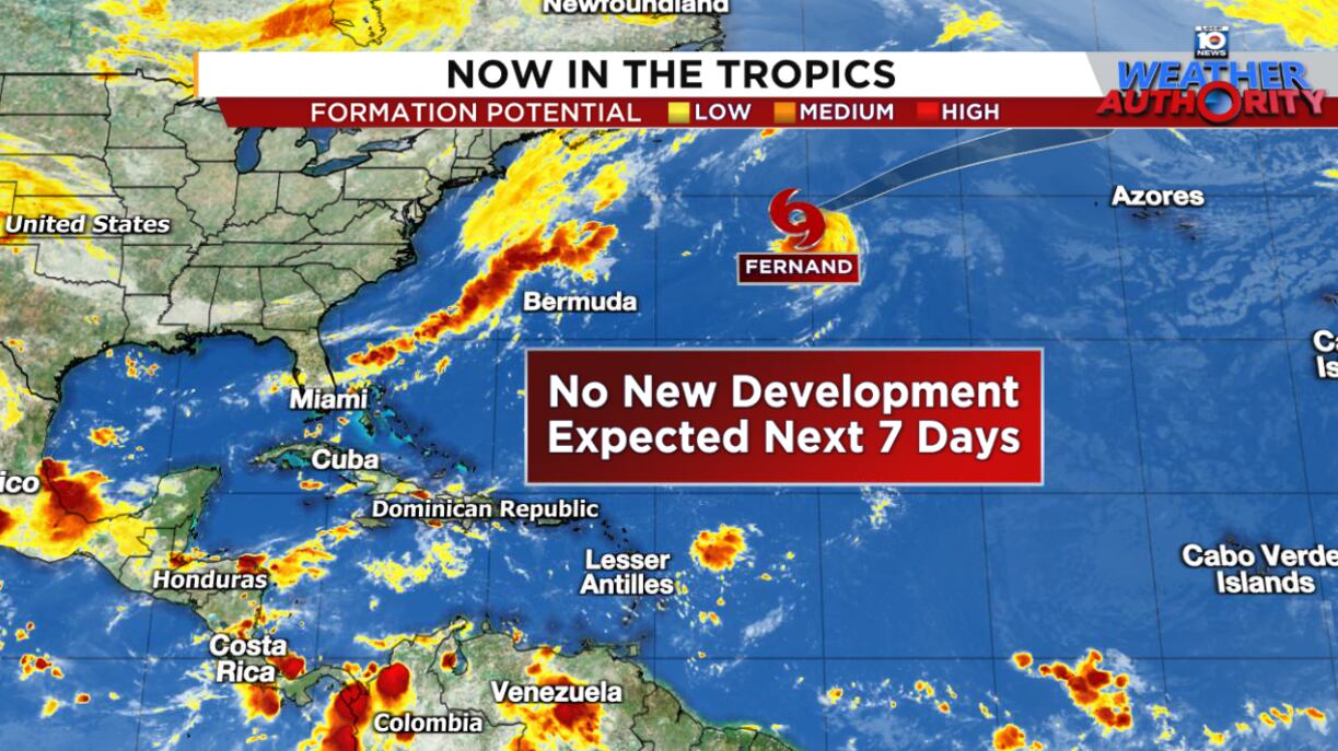
Tropical Storm Fernand, which formed on Saturday over the open Atlantic, found a pocket of warm water on Tuesday that let it live another day. With water temperatures quickly tumbling in the much cooler far North Atlantic, the end is near for Fernand, which is expected to lose its tropical characteristics over the next 12 to 24 hours.
Tropical Atlantic simmers down
Hurricane activity usually comes in fits and starts and we’re headed into a short intermission before activity ticks up again, likely around the second week of September.
With the traditional peak of hurricane season only weeks away, the Atlantic is overall a hospitable place for would-be storms, with waters across the basin nearing their annual peak. We’ll enjoy the lull while we have it since we’ll likely see another active stretch as we head deeper into September.
We’ll keep an eye out for mischief along a stalled cold front draped off the U.S. East Coast next week, but for now, forecast models keep any low-pressure areas disorganized and decidedly non-tropical.
CLICK HERE to download the Local 10 Weather Authority’s 2025 hurricane survival guide.
Copyright 2025 by WPLG Local10.com - All rights reserved.
