
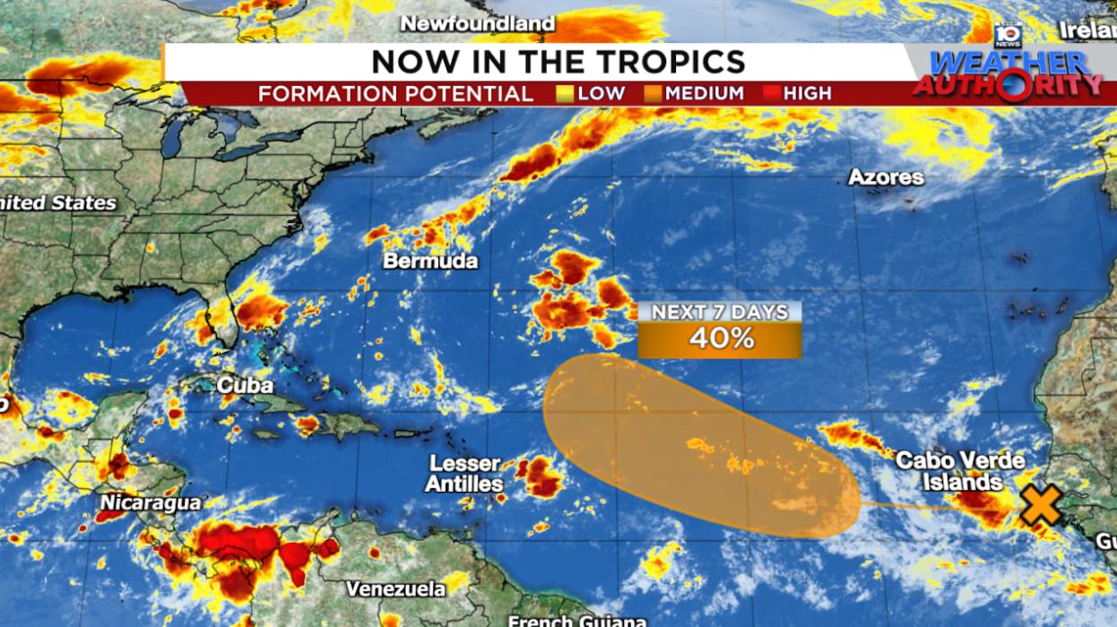
The tropical wave we’ve been previewing all week has finally emerged off the coast of Africa and is expected to gradually develop deeper into next week as it passes harmlessly over the open Atlantic.
Forecast models are advertising a mostly benign journey until late next week and next weekend (the weekend of September 20th) when the disturbance is farther north and west and in a less hostile environment.
As we’ve noted in previous newsletters, the newcomer AI-based models are more bullish on this one than their conventional physics-based counterparts. If anything, the physics-based models like the American GFS and Euro have pulled back, becoming more bearish in their development signals since yesterday.

Of the AI models, Google’s DeepMind hurricane model remains most bullish on development later next week.

Regardless, this one doesn’t appear to be a threat to land over the next week. We’ll of course watch the trends for any southward shifts towards the islands, but odds favor a turn into the open Atlantic.
Atlantic activity picks up but no foreseeable threats
Longer-term projections continue to support a more active Atlantic beyond next week. Models are advertising healthier disturbances rolling westward through the deep Atlantic to round out the month but for now it’s too soon to know what may come of these systems.
It’s just a gentle reminder to stay vigilant, especially as we get into early October when some of our bigger threats often surface out of the Caribbean, Gulf, and waters closer to the U.S., with less warning than the long-track storms of September.
CLICK HERE to download the Local 10 Weather Authority’s 2025 hurricane survival guide.
Copyright 2025 by WPLG Local10.com - All rights reserved.
