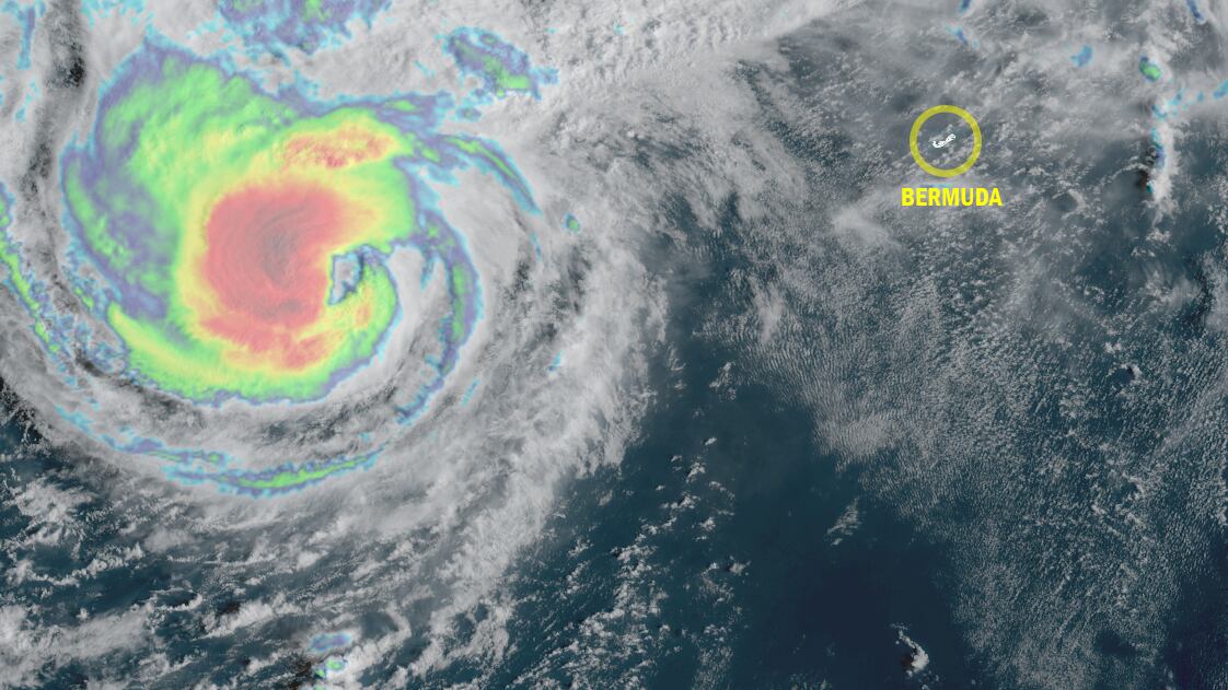
Hurricane Imelda is accelerating away from the U.S., but strengthening on a beeline to Bermuda for later today, where it’s forecast to bring strong winds to 100-plus mph, flooding rains, and powerful and destructive waves.

Though the hearty but diminutive archipelago – only about a third the size of the District of Columbia – is no stranger to hurricanes, having been directly affected by 6 hurricanes over the past 22 years alone (most recently Ernesto last August), Imelda is threatening to deliver a searing blow over the next 24 hours, finding an alley-oop from the jet stream that’ll help juice its backside winds as it swings through Bermuda tonight.
Air Force Hurricane Hunters investigating Imelda Wednesday morning found pressures tumbling into the 960s, a sign that the hurricane is quickening its pace of strengthening. Though winds hadn’t quite caught up to the pressure falls, the faster forward speed and storm motion will hasten that process today, and Imelda’s strong winds will be skewed to its northwest side because of it, unlike more conventional hurricanes, where winds are usually highest to the northeast.

Models continue to advertise the development of a sting jet, something we’ve covered in this newsletter the past few days, as dry air quickly wraps in during an extended extratropical transition that’ll begin later today. The enhanced corridor of violent winds will come right as Imelda passes near or over Bermuda and could worsen its impact on the area.

Models are divided on what happens to Imelda after tomorrow, with the American GFS leaving it stranded over the open Atlantic but most other reliable guidance whisking it with the jet stream flow into the North Atlantic as a powerful hurricane-strength extratropical storm.
Humberto merging with a front
Humberto is getting strung out along a front over the western Atlantic north of Imelda and is quickly losing any identifiable tropical features.
While Humberto isn’t any threat to land, it and Imelda will continue to bring dangerous surf across the western Atlantic and up and down the U.S. Eastern Seaboard this week, with a high risk of rip currents at least for the next several days.

No threats for now behind Imelda and Humberto
As we mentioned in Tuesday’s newsletter, models do suggest the possibility of another system in the eastern and central Atlantic in about a week. It’s a little unusual to get development this far east into October, but we’ll keep an eye on the trends just in case it sneaks far enough west to pose any issue for the islands.

For now it’s nothing to worry about.
Copyright 2025 by WPLG Local10.com - All rights reserved.
