
As we’ve been previewing in this newsletter for over a week now, forecast models are hinting at some signs of life over the traditional Main Development Region of the tropical Atlantic — between Africa and the Caribbean — as we approach the middle part of the month.
The Main Development Region of the Atlantic often roars to life by middle to late August during most hurricane seasons, but this year could sound more like a murmur given the Atlantic’s unusually hostile posture.
Models appear to be keying in on two distinct disturbances for next week – the leading one exiting the African coast today and another disturbance rolling off Africa around next Tuesday.

At this stage, neither disturbance shows great promise, but low development odds are now reflected in most of our major model camps, including the traditional physics-based European and American GFS ensembles, as well as the newer AI-based modeling systems.
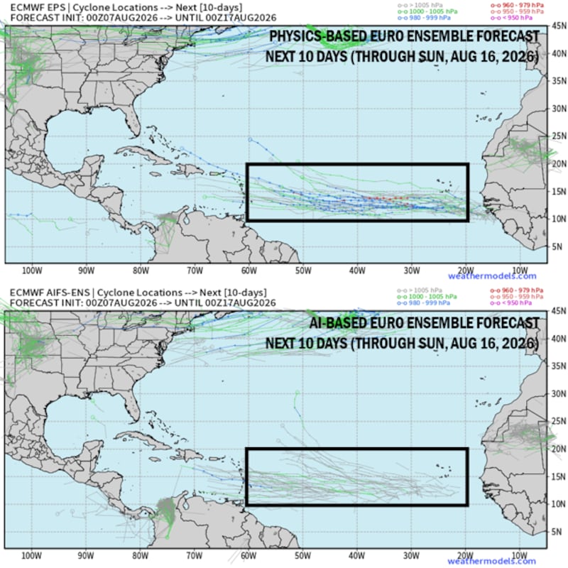
Interestingly on Friday, the modeling camps have flipped, with the AI-based models less enthusiastic and the traditional physics-based models a little more bullish. Google’s bellwether DeepMind machine learning-based ensemble system, which was first to pick up on the possibility of development over a week ago, has become more bearish in recent runs.
The good news is that in addition to low development odds overall, models generally keep the system weak (tropical depression or tropical storm) in the scenarios where development occurs.
Given the curtain of wind shear laid across the western Atlantic, this one should hit a major roadblock as it enters the central Atlantic next weekend (weekend of Aug. 16) into the following week (in about 10 days).
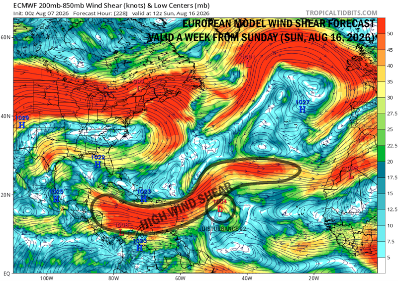
It’s unclear yet which of the two disturbances (if either) might try to develop, but models generally favor the second (trailing) disturbance set to move off Africa early next week.
Given the marginal environment for development, with lots of dry, dusty air infiltrating the tropical Atlantic next week followed by increasingly hostile wind shear, don’t expect too much out of this one other than perhaps a low-key kickoff to what’s typically the busiest -week stretch of the season.
Copyright 2026 by WPLG Local10.com - All rights reserved.
