
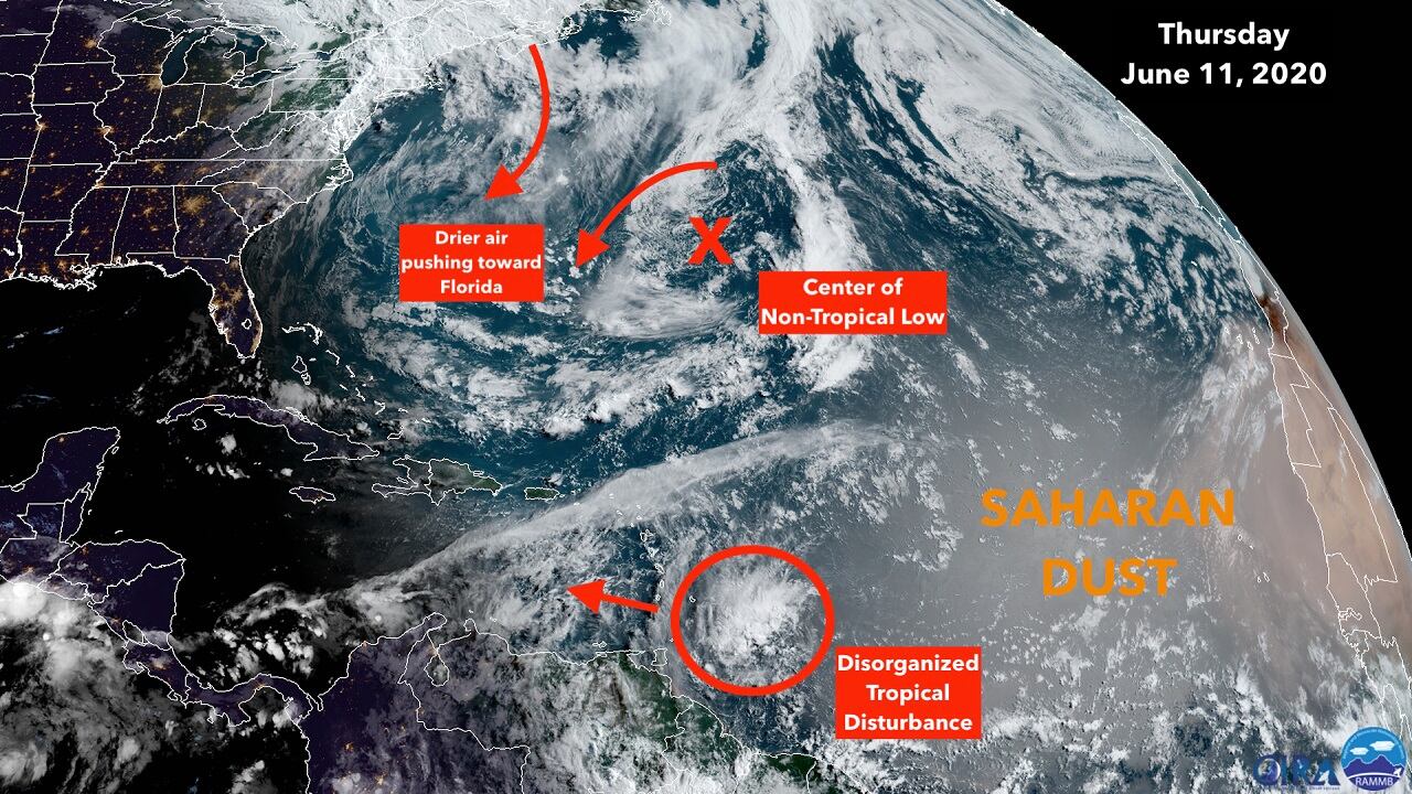
A small but well-defined tropical disturbance is located a couple hundred miles east of the southern Caribbean islands. The upper-level winds are not conducive for significant development, but gusty squalls will likely accompany the disturbance as it moves through the southernmost islands later today.
Disorganized disturbances of this type – technically tropical waves – are the seeds from which most strong hurricanes develop later in the hurricane season. It appears, however, that this one will not be able to develop, and simply become part of a moisture surge that will affect South Florida early next week.
Most June tropical storms and the very occasional hurricane developed in the western Caribbean or the Gulf of Mexico – where this one is headed. But a strong dip in the jet stream is coming along that should prohibit any development. Instead, the dip will likely scoop up moisture from the disturbance, and from the tropics in general, and pull it north. That significant moisture channel is forecast to come over or very near South Florida, so more rain is in the forecast for early next week.
The disturbance is near the leading edge of a plume of Saharan Dust that will spread west all the way to Florida over the next week or two. That dry air should keep the tropical weather in the Atlantic calm.
Elsewhere, the non-tropical low east of Bermuda is not expected to develop any tropical characteristics. The flow around it will affect South Florida’s weather, however, by providing part of the push that will bring drier air over us for tomorrow into Saturday. The drop in humidity should be noticeable.
Otherwise, no tropical development is expected into next week.
Copyright 2020 by WPLG Local10.com - All rights reserved.
