

Hurricane researchers at Colorado State University (CSU) – the group that pioneered seasonal hurricane predictions in the 1980s – issued their first outlook of 2026 Thursday morning, predicting slightly below average named storm and hurricane activity for the upcoming Atlantic hurricane season, which runs from June 1 through Nov. 30.

CSU hurricane researchers are predicting 13 named storms (tropical storms and/or hurricanes) in 2026, 6 hurricanes, and 2 Category 3, 4, or 5 hurricanes with maximum winds of at least 111 mph.

The team’s forecast is below the 30-year seasonal average of 14 named storms, 7 hurricanes, and 3 Category 3 or stronger hurricanes.
Overall tropical activity for the Atlantic as measured by the Accumulated Cyclone Energy or ACE is forecast to be at its lowest level since 2015.
The April forecast is the first below-average hurricane season outlook the CSU team has issued since 2023 and the lowest activity they’ve predicted since 2019. Forecasters note that their April outlook has lower skill than subsequent outlooks issued in June, July, and August. Despite below average April outlooks in 2023 and 2019, for example, both hurricane seasons ended with above average activity.
It’s worth noting that seasonal forecasts cannot pinpoint when or where a hurricane might strike and coastal residents shouldn’t change their preparations based on seasonal outlooks.
“Coastal residents are reminded that it only takes one hurricane making landfall to make it an active season for them,” cautions CSU’s hurricane research team.
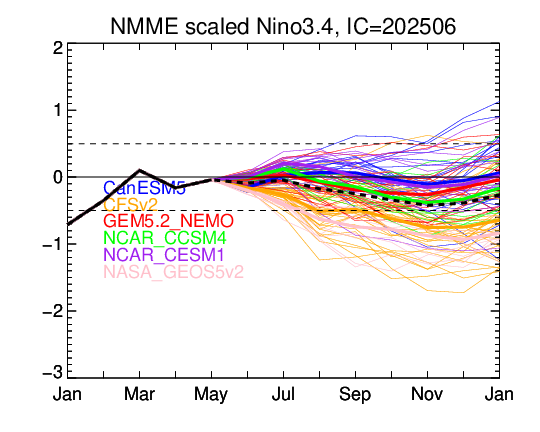
A supercharged El Niño for the ages?
The culprit tilting CSU’s initial hurricane season outlook to suppressed Atlantic storm activity is a banner El Niño heralded by long-range computer models for the peak months of the hurricane season in August, September, and October.
El Niño conditions occur when waters straddling the equator in the eastern Pacific Ocean are abnormally warm. This pool of unusually warm water in the equatorial Pacific alters atmospheric patterns, often sending storm-slicing wind shear and sinking air into the tropical Atlantic, tamping down would-be hurricanes. In general, the stronger the El Niño, the higher the hurricane kryptonite for the Atlantic.
Since last fall, waters surrounding the equator in the eastern Pacific have been cooler than average, with La Niña conditions – the counterpart to El Niño – peaking during the winter months.

Those abnormally cool waters in the region scientists monitor for La Niña and El Niño are in the process of quickly retreating, to be replaced by much warmer waters lurking below the ocean surface.
A pair of strong tropical systems on either side of the equator in the western Pacific this week – once Category 5 equivalent Maila to the south and the large circulation around soon-to-be Sinlaku to the north – will funnel an intense burst of west-to-east flowing winds along the equator, countering the cooling effect of the routine east-to-west flowing trade winds, sloshing a well of well of warm water toward the central and eastern and Pacific.
Computer models suggest the pronounced westerly wind burst from these twin western Pacific storms could hasten a transition to El Niño in the weeks and months ahead. In fact, one of our leading long-range models is advertising an aggressive warm up culminating in the strongest El Niño in at least 50 years by this fall, rivaling or eclipsing the mammoth, so-called “Super” El Niños of 2015, 1997, and 1982.

These previous Super El Niños were also preceded by similar twin cyclone westerly wind bursts or significant springtime tropical activity in the western Pacific which research finds can incite extreme El Niños.
April is a notoriously difficult month to predict future El Niño conditions – so much so that it’s been termed the Spring Predictability Barrier – so it’s worth approaching these extreme forecast scenarios with some skepticism. That said, multiple seasonal forecast models, including the North American Multi-Model Ensemble have been increasingly bullish on a strong El Niño emerging while federal forecasters suggest 80% odds of El Niño conditions by the peak months of the hurricane season.

Why this El Niño will probably affect hurricane season differently than the last
The last strong El Niño came back at the end of 2023.
At the start of the 2023 hurricane season, I wrote about the tug-of-war between the developing El Niño and near-record warm tropical Atlantic waters. At the time, I indicated the warmth of the Atlantic might counteract the otherwise quieting effects on the Atlantic hurricane season of the blockbuster El Niño advertised by forecast models.
As it turns out, 2023 was a very active hurricane season with 20 named storms despite the presence of a strong El Niño during the peak of the season.
Unlike 2023, 2026 is starting with a substantially cooler tropical Atlantic.
The relative warmth of the Atlantic compared to the eastern equatorial Pacific matters a lot and long-range models continue to show a tepid Atlantic into the peak of the season as waters in the eastern Pacific sizzle.

If these forecasts verify, it would portend an uphill battle for developing storms in the Atlantic this hurricane season.
Don’t let the below average forecasts fool you
As we’ve learned in the past, bad, destructive hurricanes still happen in down El Niño years.
The 1965 hurricane season saw a strong El Niño in the Pacific and below average hurricane activity in the Atlantic. The season recorded only one major (Category 3 or stronger) hurricane, but that storm was Billion Dollar Betsy, the first-ever billion-dollar storm that wreaked havoc on South Florida and southern Louisiana.
Regardless of the seasonal forecast, prepare this year as you would for any hurricane season. Have a plan and always be ready for your one.
Copyright 2026 by WPLG Local10.com - All rights reserved.
