
A few weeks ago in this newsletter, we wrote about the very low concentrations of Saharan dust across the Atlantic headed into what is typically the peak weeks of the Saharan dust season in late June and July. This week, however, the biggest dust outbreak of the year is trying to make up for lost time, with the first round of dust reaching the sands of South Florida yesterday and even thicker dust reinforcements moving over Florida and into the Gulf by this weekend, settling over coastal Texas by the early to middle part of next week.
The annual dust cycle not only plays into the hurricane season – with healthy loads of dust helping to fend off early tropical systems before typically dropping off in August – but also feeds marine ecosystems with essential nutrients and provides essential fertilizer to the soils of the Amazon rainforest basin near the eastern coast of South America.
For the larger dust outbreaks that travel all the way to the U.S. mainland, turning blue skies milky white and suppressing summertime thunderstorms, the mineral dust can reduce air quality and aggravate respiratory conditions such as asthma, COPD, and chronic bronchitis in more vulnerable populations. It’s uncommon for dust concentrations to reach those unhealthy levels in the U.S. but it’s worth monitoring air quality levels for particularly sensitive groups.
The dust-free state of Florida
Florida has had a remarkably dust-free year until this week, recording by far its lowest levels of Saharan dust since satellites began regularly measuring these aerosols back in 2002.

The plot above tracks dust cover over the entire state through this past Tuesday (July 7th), but doesn’t include the first major push of dust we began seeing Wednesday in South Florida that’ll spread into northern parts of the state today and on Friday. Another thicker surge of dust is expected to dull our sunny skies over the weekend – especially through Florida’s peninsula – and possibly reach coastal Texas by next Tuesday into Wednesday, according to forecasts.

Atlantic dust hits its highest levels of the year
Through the first week of July, the dust-heavy part of the tropical North Atlantic east of the islands and west of Africa has recorded its lowest dust concentrations to-date.

This week, though, the dust should top levels observed during an exceptionally strong outbreak the week of February 15th, so far the most concentrated dust outbreak of the year. Of course, dust levels this time of year should be much higher than in February when dust levels are just coming out of seasonal lows.
Dust pouring cold water on the (already cold) Atlantic
The big dust outbreak this week will ensure the Atlantic stays dormant for the week ahead.
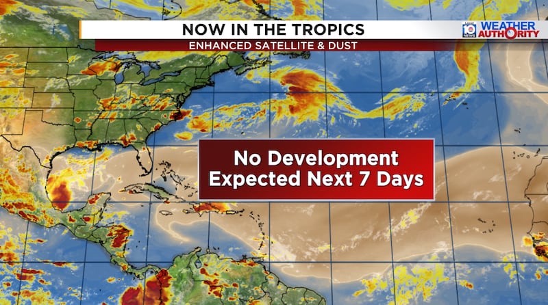
As we mentioned in Wednesday’s newsletter, the only outside shot of development in the next few weeks appears to be from an initially non-tropical low along a stalled front off the Carolinas late next week.
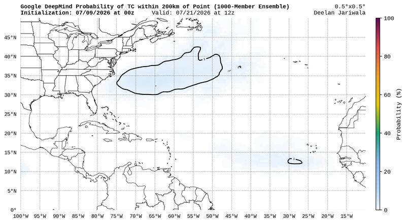
Models are ho-hum on its prospects in turning tropical, and so far they keep development odds very low (less than 10%), so it’s definitely not anything to be concerned with for now.
Copyright 2026 by WPLG Local10.com - All rights reserved.
