
The low-topped cloud swirl of Tropical Storm Bertha officially crossed the southeastern Louisiana coastline about 50 miles east of New Orleans in neighboring St. Bernard Parish Wednesday afternoon around 2 PM local time with maximum winds of 45 mph.
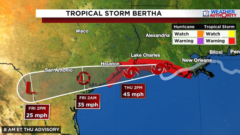
Winds, even in gusts, mostly stayed below the tropical storm threshold (39 mph) over southern Louisiana as Bertha passed over and south of the state on Wednesday into early Thursday. The maximum wind gust reported at New Orleans International Airport was 39 mph at around 5 PM local time Wednesday as the center of Bertha slid just south of the city. A coastal station at the Mississippi River delta in lower Plaquemines Parish, where the muddy Mississippi splinters into the open Gulf, reported winds gusting to 40 mph shortly before 6 PM local time Wednesday.
But for the most part, aside from churned up seas and minor coastal flooding in low-lying spots at the immediate coast, Bertha caused little to no disruption as it breezed its way through southern Louisiana. The misty, intermittent rainfall near and north of Bertha’s center stayed light, and the north-central Gulf Coast saw rainfall totals of generally less than an inch over the past 24 to 36 hours.
What’s next for Bertha on its way to Texas
Hurricane hunters flying Bertha early Thursday found its center hugging the southwestern Louisiana coastline about 60 miles southeast of Lake Charles.
Bertha’s fragile center jumped slightly south overnight but remained well north of the large thunderstorm complex and heaviest rains closing in on the central Texas coast Thursday morning.
The displacement of weather to the south of Bertha’s center indicates persistent wind shear, which, as we discussed in Wednesday’s newsletter, will ride shotgun with Bertha as it approaches the upper Texas coast today. The upshot is Bertha will remain a low-grade tropical storm as it makes a second landfall near or south of Galveston by Thursday evening.
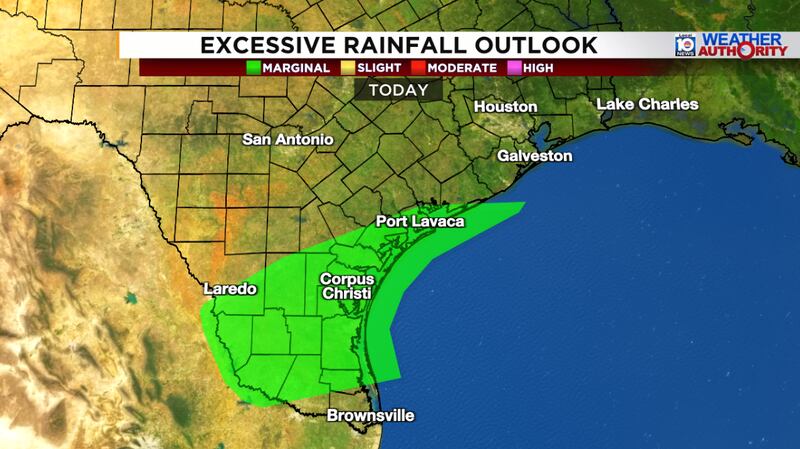
The primary threat remaining is localized heavy rainfall for South Texas (south of Bertha’s center), generally from just north of Corpus Christi southward into the lower Rio Grande Valley.
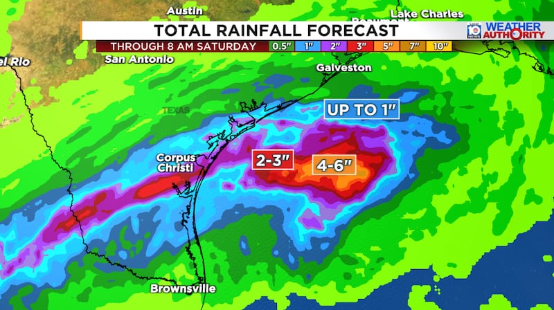
For the most part, models suggest only modest rainfall in the 1-to-3-inch range, which will limit the flash flood threat. For now, the National Weather Service has only a low risk (threat level 1 of 4) of localized flash flooding for areas of South Texas today.
Bertha will quickly disintegrate later today and on Friday as it moves farther inland over Texas.
Settling down into early August
The Atlantic basin should be on a post-Bertha hiatus into at least the first week of August, with no new development expected for the foreseeable future.
Copyright 2026 by WPLG Local10.com - All rights reserved.
