
Hurricane Dorian is mauling the Carolina coast with high storm surge and flooding rain. In South Florida, the extra hot leftover effect from Dorian continues.
Dorian has increased in intensity a little. As of the 8 a.m. advisory, its top winds are 115 mph. It's producing strong wind bands with embedded tornadoes along the Carolina coast.
Recommended Videos
Storm surge enhanced by king tides will push over the coast of South Carolina at high tide early Thursday afternoon. Dorian is offshore of South Carolina, but will track over or near the North Carolina coastline later Thursday and Friday. It appears that coastal North Carolina will get the strongest winds accompanying flooding rain and life-threatening storm surge.
These same area were pummeled by Hurricane Matthew in 2016 and Hurricane Florence last year.
CLICK HERE to have the Bryan Norcross Talks Tropics newsletter delivered to your inbox
Virginia, the Mid-Atlantic and the Northeast will also feel the effects of Dorian Friday and Saturday as it speeds off to the north. Significant coastal effects are possible on the Mid-Atlantic coast from Virginia to Delaware and on Cape Cod. Eastern Long Island will get some of the outer bands, and the water will be high along the Atlantic beaches.
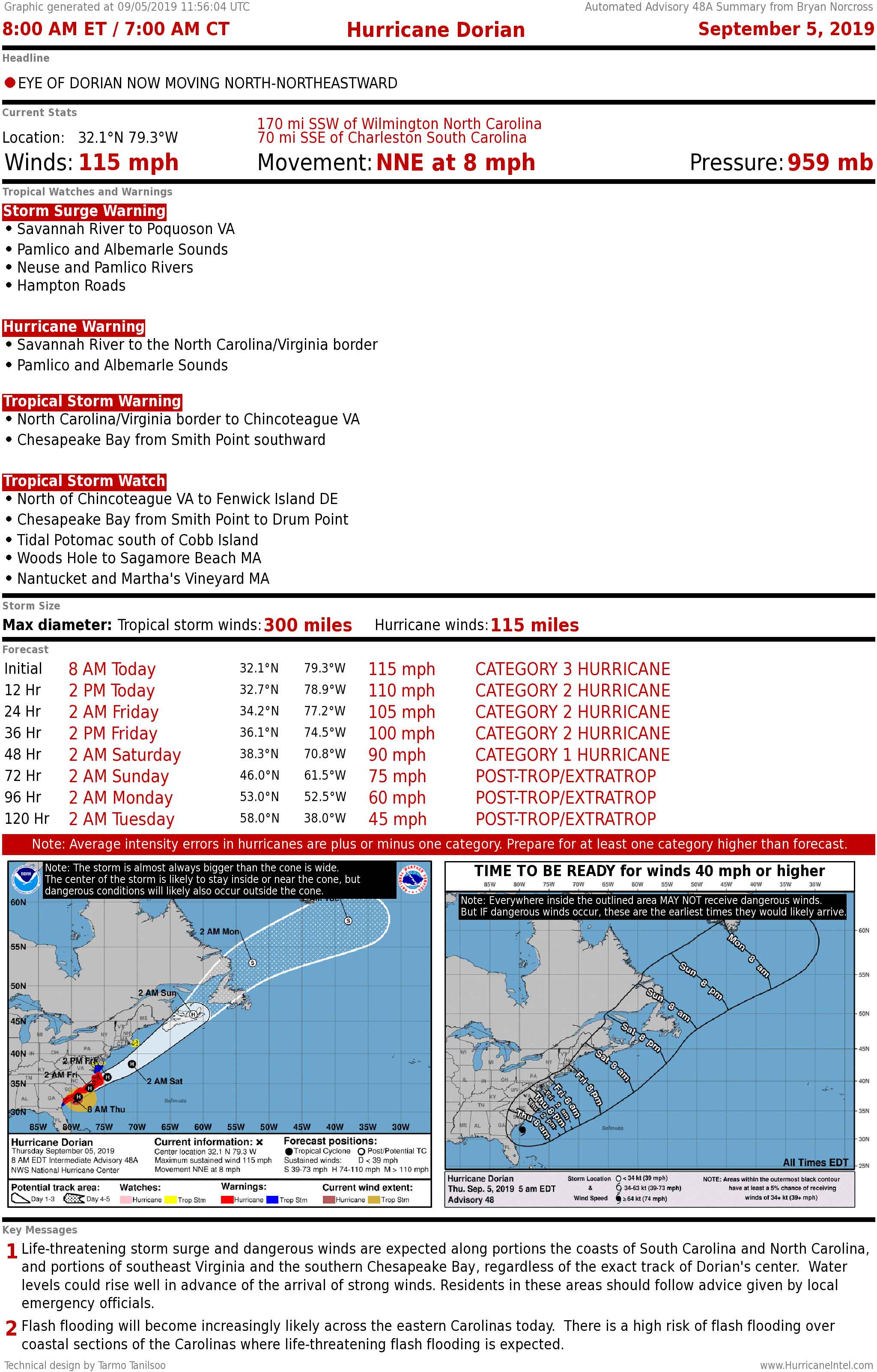
The key messages from the National Hurricane Center on Dorian are:
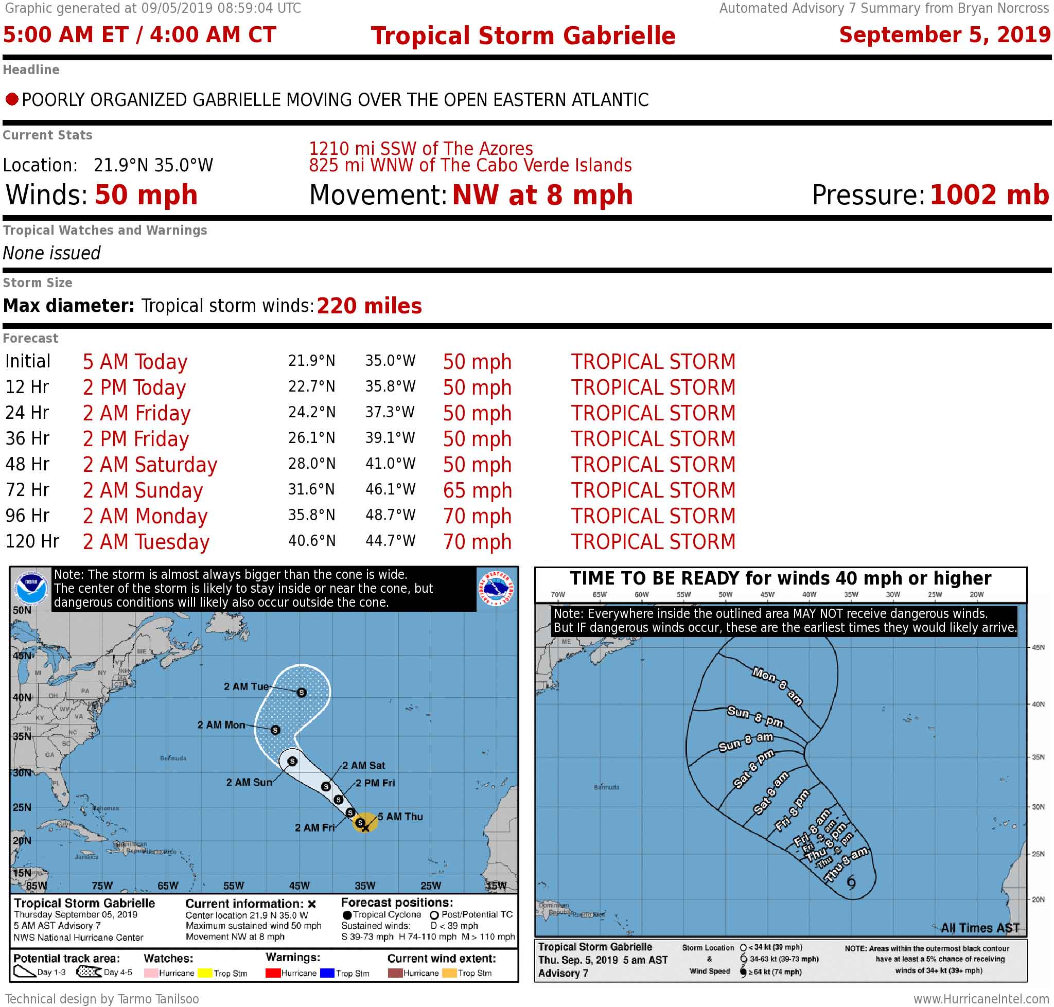
Elsewhere in the tropics, on the other side of the Atlantic, Tropical Storm Gabrielle is weak and will track out to sea. There is another system in the middle of the Atlantic that has a decent chance of developing north of Bermuda. It won't threaten land.
A small disturbance is east of the Caribbean islands and has a slight chance to develop, but does not appear to be a threat at this time. And a strong tropical disturbance has moved off of Africa. We will watch for its development and the development of the one behind it next week.