
Hurricane Dorian is brushing extreme northern New England and heading toward Atlantic Canada on Saturday.
We’ll be watching a couple tropical disturbances currently near Africa in the coming week.
Recommended Videos
Hurricane Dorian is offshore of Maine but close enough to bring gusty winds and periods of rain to coastal sections, especially along the northern part of the coast and down East Maine.
The storm is forecast to make landfall in Nova Scotia, Canada later Saturday with hurricane-force winds then weaken as it transitions into a North Atlantic storm. That will officially be the end of Dorian.
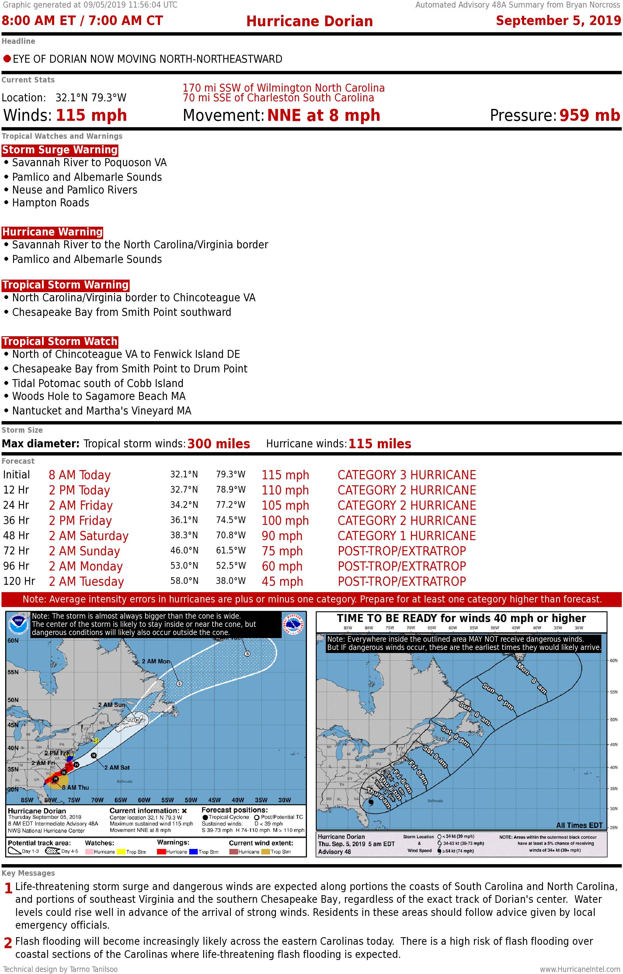
Dorian set numerous records, including being the slowest-moving Cat 3+ hurricane, and the strongest hurricane to ever hit the Bahamas.
In fairness, however, the Great Abaco Hurricane of 1932, which also hit Marsh Harbor and the nearby islands, is estimated to have been a Category 5 as well, but with winds topping out at 160 mph. But that’s a modern estimate, subject to fairly large errors.
Elsewhere in the Atlantic, there are a couple tropical disturbances near Africa that we’ll watch next week.
The computer forecast models say it will take one or both nearly a week to reach the eastern Caribbean islands because the steering flow is relatively weak. There is no reason to think much more about them until they get much farther west.
Tropical Storm Gabrielle is forecast to become a hurricane in the middle of the Atlantic. It might transition into a winterlike North Atlantic storm and threaten northern Scotland next week.
Finally, a very weak disturbance is more than 600 miles east of Puerto Rico. It has a slight chance of eventually developing, but more likely it will simply be a moisture surge when it passes Florida late in the week.