

The summer vacation the Atlantic’s taken for much of July has been a welcome sight, but there are signs the vacation may be coming to an end as we close out the month.
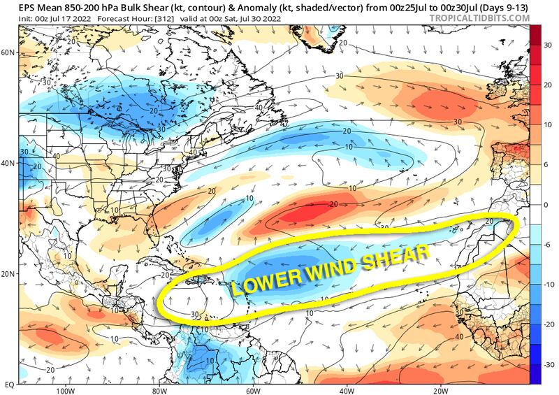
The sinking, stable air that’s dominated the tropical Atlantic in recent weeks will depart and the very hostile wind shear – well above average for the time of year – that’s kept fledgling systems disorganized is forecast to weaken.
These developments should provide a more conducive environment for tropical development across the Atlantic as we head into August, when tropical activity naturally begins to tick up.

This week will be a transition week in the Atlantic as the basin begins to shake out the largely inhospitable atmosphere. For the near term – likely through the work week – this means we can expect mostly quiet conditions to persist.
By late next weekend and next week, however, we’ll need to keep a closer eye to any robust disturbances that try to take advantage of increasingly less hostile conditions. While our forecasts models aren’t homing in on any specific yet, large-scale signals indicate that may soon change.
In the meantime, the eastern Pacific continues its impressive run of storms.
Estelle, located about 300 miles south of the southern Mexico coast, is now a hurricane and is forecast to strengthen into a Category 3 hurricane later this week.
This would be the third Category 3 hurricane so far of the eastern Pacific hurricane season and well ahead of the mid-September average for the third Category 3 storm.
Behind Estelle, the Pacific looks to finally settle down some this week, with no new development expected over the next few days.
Copyright 2022 by WPLG Local10.com - All rights reserved.
