
Tropical Depression Two, which formed Sunday morning over the northeastern Gulf about 150 miles west of Tampa, is expected to become Tropical Storm Bertha, the second named storm of the 2026 Atlantic hurricane season, later today.
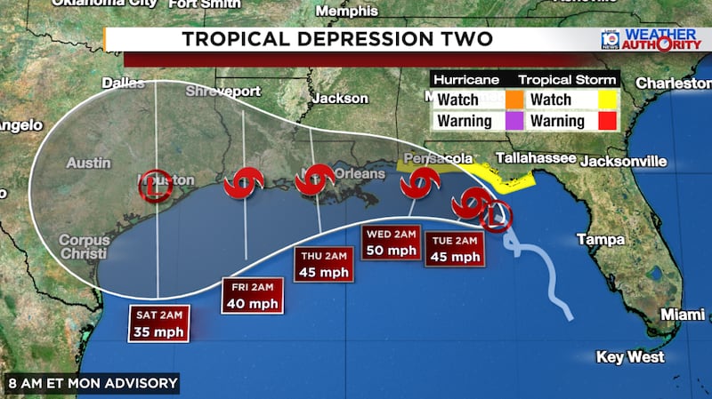
The system remains weak and disorganized – battling environmental adversaries like wind shear and dry air that we previewed in this newsletter last week – with only sporadic and patchy thunderstorms near its nascent center.
Slow and steady pressure falls reported by an Air Force Reconnaissance Hurricane Hunter airplane investigating the depression early Monday, however, indicates at least gradual organization of the surface circulation. Only a slight tick up in estimated surface winds (from 35 mph to 40 mph) will get us to Tropical Storm Bertha, which should come by this afternoon.
In terms of its track, the forecast is fairly straightforward, with a slow plod westward this week underneath a building high-pressure ridge nosing into the northern Gulf from the central U.S.
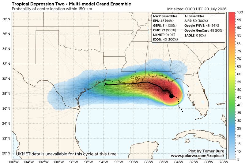
Significant strengthening not in the cards
The forecast for soon-to-be Bertha is fraught with impediments that should stymie strengthening in the days ahead. Nearly all reliable intensity guidance keep the system from climbing much above a low-to mid-tier tropical storm, and only about 3% of the 1,000-member Google DeepMind ensemble system scenarios show Bertha reaching hurricane strength.
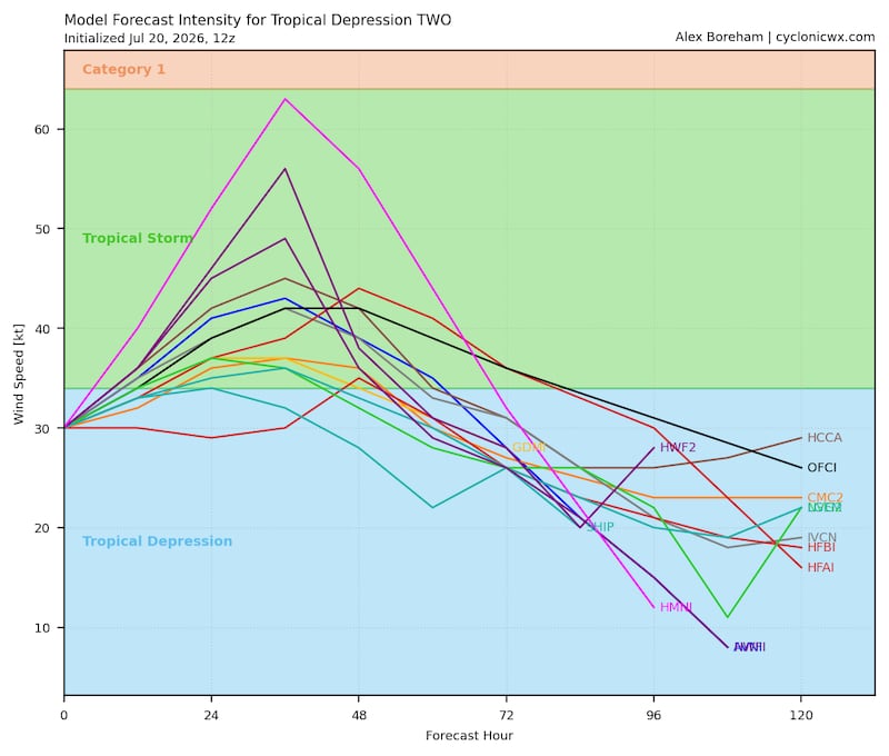
If you spend enough time online, you’ll find bad actors sharing outlier computer models depicting scary-looking hurricane scenarios. These rogue models typically have abysmal hurricane track records (such as the German ICON) or aren’t designed and shouldn’t be used for hurricane forecasting (such as the RRFS).
So while Tropical Storm Watches stretch across parts of the northern Gulf Coast from Florida’s Panhandle to coastal Alabama in anticipation of winds above 38 mph, for now we’re not expecting widespread damaging winds for these areas.
Heaviest rains stay offshore for now
The primary hazards will be from locally heavy rainfall and dangerous rip currents as the storm slides westward along the north-central Gulf this week.
The heaviest rainfall will depend on the exact track of future Bertha and the heaviest rain totals will remain on the south side of its track, which largely stays offshore this week. A nudge northward could bring heavier totals over land, so we’ll want to watch the trends.
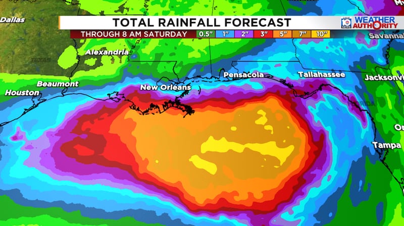
For the time being, we’re not expecting a widespread flood threat, but instead, mainly localized flooding from slower-moving outer bands around the system along the north-central Gulf through Thursday. The higher risk of scattered flash flooding will come from late Tuesday through Thursday from southern Louisiana to southeastern Texas.

Simmering Gulf waters kept in check
The biggest factor favoring organization is the near-record water temperatures for the time of year in the northern Gulf. We discussed this extensively in last Wednesday’s newsletter for what was (at the time) the less likely outcome:
“It’s the westward path over the northern Gulf that would leave it over record to near-record warm waters and the scenario that would raise the specter of pure tropical development.”
That notable shift westward by the models over the weekend now keep the system lingering over those seasonably waters this week.

The good news, though, are all the limiting factors we discussed working to tap the brakes over this part of the Gulf. By Wednesday, especially, a curtain of northerly shear and land interaction should begin to gut what remains of the storm as it approaches Louisiana.
The only game in town for now
Across the remainder of the Atlantic, especially through the deep tropics, things look to stay quiet to round out July, with no additional development expected elsewhere over the next week or two.
Copyright 2026 by WPLG Local10.com - All rights reserved.
