
Genevieve rapidly strengthened 75 mph in just 24 hours over the eastern Pacific over the weekend to top the scales as a Category 5 hurricane by the pre-dawn hours Monday. The frequency of such explosive strengthening is rare in the eastern Pacific – fewer than 1% of all “fixes” (6-hourly position and intensity estimates) made since 1970.

Genevieve is the first Category 5 hurricane in the eastern Pacific since Kristy in October 2024 and only the 21st Category 5 hurricane observed in the eastern Pacific since routine satellite monitoring began 60 years ago.
Eastern Pacific kicking into high gear
Genevieve and its predecessor Fausto – which peaked as a Category 2 hurricane last Friday – pushed overall tropical activity in the eastern Pacific to above average levels for the season. The eastern Pacific hurricane season begins earlier than the Atlantic (May 15th versus June 1st in the Atlantic) and activity typically ramps up much sooner – by the first week of July in the eastern Pacific versus late August in the Atlantic.
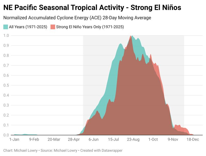
During strong El Niño years like this, we often see a later ramp up to eastern Pacific seasonal activity – similar to what we’ve seen over the past week – with a more defined peak in mid-August and a later end to the hurricane season than in non-El Niño years.
Though the center of a weakening Tropical Storm Fausto will pass about 100 to 150 miles to the north of the Hawaiian Islands today and tomorrow, treacherous surf and large breaking waves – with surf reaching 14 to 18 feet – will cause problems for east-facing shorelines and lead to dangerous marine conditions and coastal flooding issues, especially around the times of high tide, primarily through Wednesday evening local time.

Genevieve remained a powerful hurricane early Tuesday but is expected to gradually weaken this week over the open Pacific and poses no threat to land.
August in like a lamb in the Atlantic
Wind shear remains exceptionally high across the bellwether Caribbean and into the tropical Atlantic.

In fact, over the past two weeks, wind shear over the western Atlantic has been highest on record (since at least 1979), surpassing even other strong El Niño years like 2015.
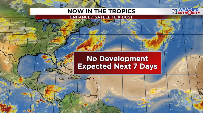
The hostile shear is forecast to continue for the foreseeable future and the Atlantic is expected to stay dormant through at least the first week of August.
Copyright 2026 by WPLG Local10.com - All rights reserved.
