

Hurricane Polo – currently paralleling Mexico’s Pacific coastline about 200 miles southwest of Acapulco – was a fledgling 45-50 mph tropical storm early Monday but underwent an extreme bout of rapid intensification over the past 24 hours, strengthening to a monstrous 160 mph Category 5 hurricane by Tuesday morning.
Officially, Polo strengthened 110 mph between 8 AM ET Monday and 8 AM ET Tuesday, an extreme rate only matched or exceeded once – by Hurricane Patricia in 2015 – in the reliable records for the eastern Pacific (since around 1970).
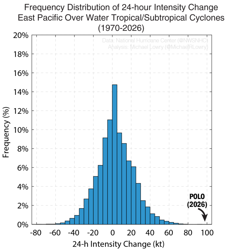
Polo also marks a record-tying 3rd Category 5 hurricane this season for the eastern Pacific. Only the 2018, 2002, and 1994 eastern Pacific hurricane seasons have had as many Category 5 hurricanes in a single season.
At extreme intensities like Polo, hurricanes are prone to fluctuations up and down, but Polo should stay near or at Category 5 intensity for the next day or two as it sits in a pristine environment.
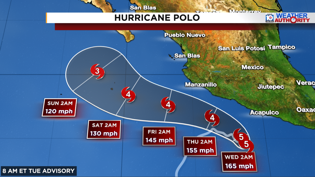
The good news is the catastrophic core of Polo will remain well off the coast of Mexico this week, but heavy rains from the hurricane’s outer bands could produce flash flooding and mudslides for coastal areas of southwest Mexico through Thursday, including across parts of coastal Guerrero and Michoacán.
Mostly sleepy Atlantic
Fay has breathed its dying breath over the open northeastern Atlantic and its leftover swirl of low-level clouds will spin harmlessly over the open Atlantic for the remainder of the week.

A disturbance forecast to move off the coast of Africa on Wednesday has a low shot at developing, but will lift quickly northward and shouldn’t amount to very much regardless.
Otherwise we’ll continue to watch the development of a coastal storm/nor’easter off the Eastern Seaboard later this week. Most models suggest it stays non-tropical, but there’s an outside chance it transitions into a subtropical or tropical system as it loiters along the Mid-Atlantic and Northeast this weekend into early next week.

For now, NHC isn’t mentioning it in its tropical weather outlook and regardless, the impacts shouldn’t change appreciably for coastal areas affected by repeated rounds of tidal flooding, gusty winds exceeding 45 mph, and periods of heavy rain.
Copyright 2026 by WPLG Local10.com - All rights reserved.
