
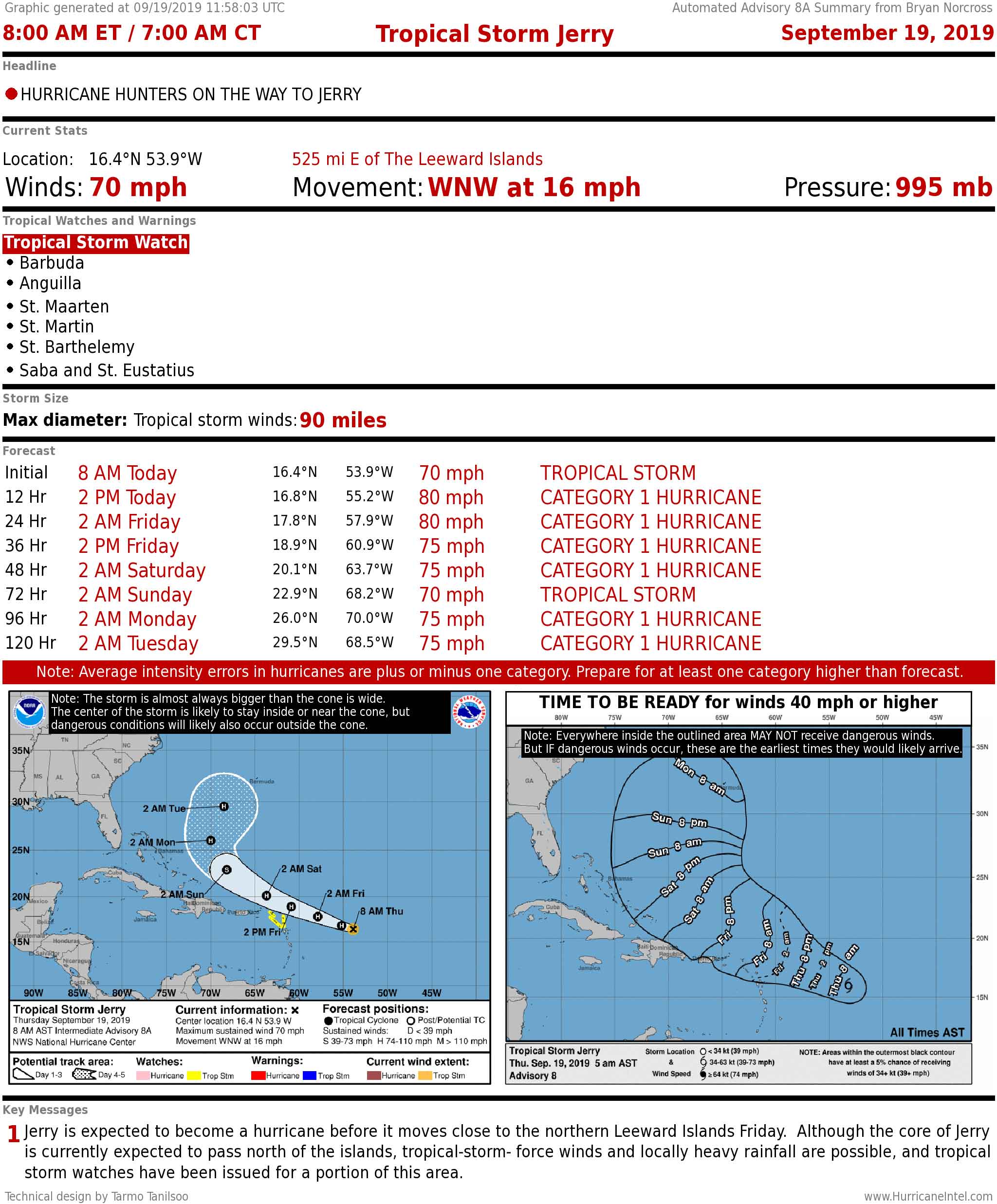
Tropical Storm Jerry became a hurricane Thursday as it moves near the northeastern Caribbean islands. Hurricane Humberto has moved past Bermuda. There's also a tropical disturbance behind Jerry to watch.
This weekend is the peak of hurricane season for South Florida. The good news is, there are no immediate threats.
Recommended Videos
JERRY strengthened to a hurricane as it tracks near the northeastern Caribbean islands. Dry air and somewhat unfavorable upper winds are on Jerry's track, so it's not expected to be able to intensify in any dramatic way. Still, gusty winds and heavy rain are possible on the islands closest Jerry's path.
CLICK HERE to have the Bryan Norcross Talks Tropics newsletter delivered to your inbox.
Bear in mind that predicting exactly how apparent negative factors will affect a hurricane's intensity is intrinsically error-prone. So allow for the possibility of a stronger storm coming near the islands.
If everything goes right, the tail of Humberto will initially pull Jerry north. Assuming Jerry gets as far north as forecast, a dip in the jet stream should come along and steer the storm out to sea well before it gets to the Bahamas. But that won't happen until the weekend.
HUMBERTO is past Bermuda. The strong winds and very high surf are slowly let up. Humberto will get caught up in the jet stream by tomorrow and head out to sea.
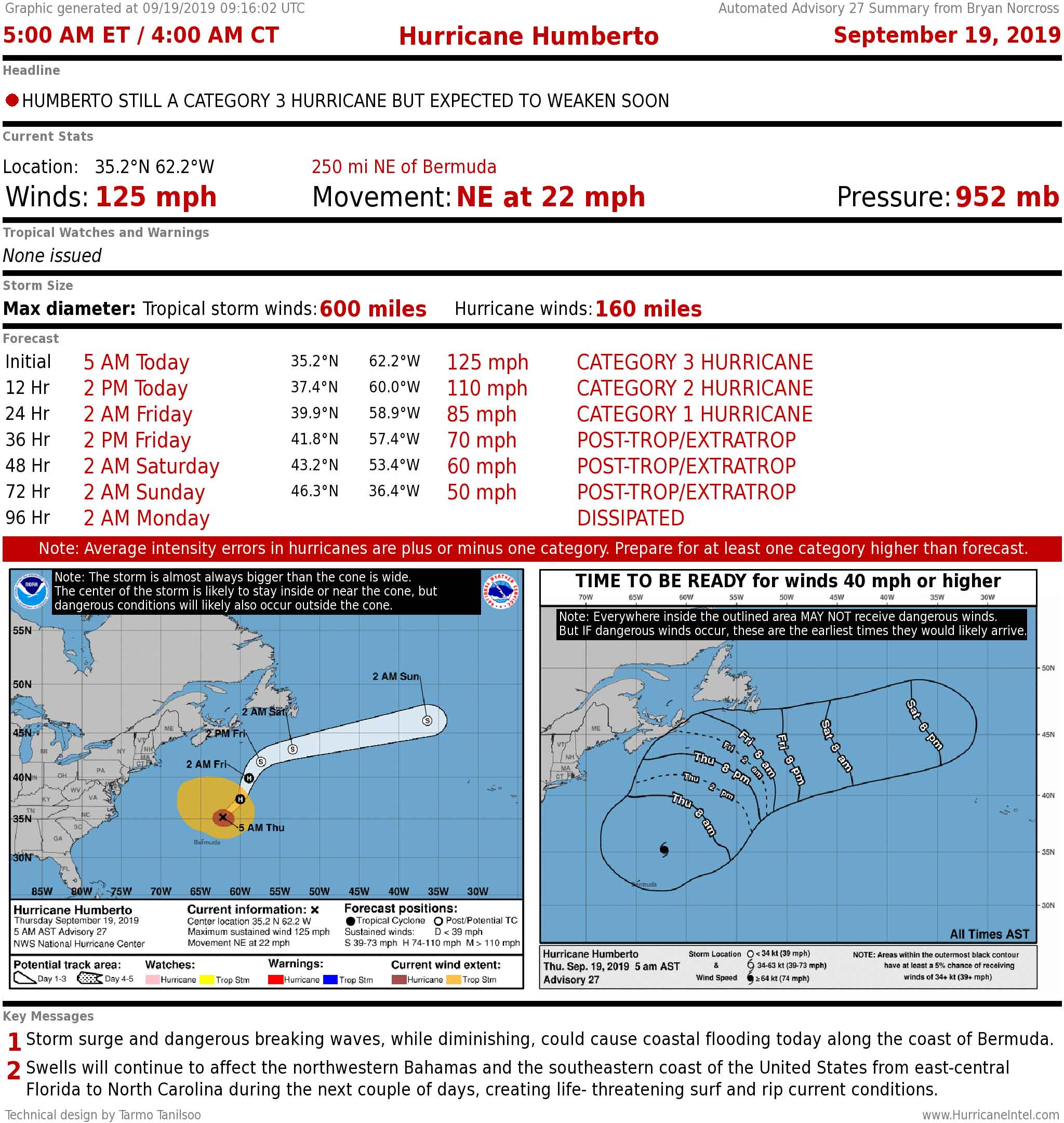
Dangerous ocean conditions from Humberto are still occurring from north of Palm Beach to the Carolinas.
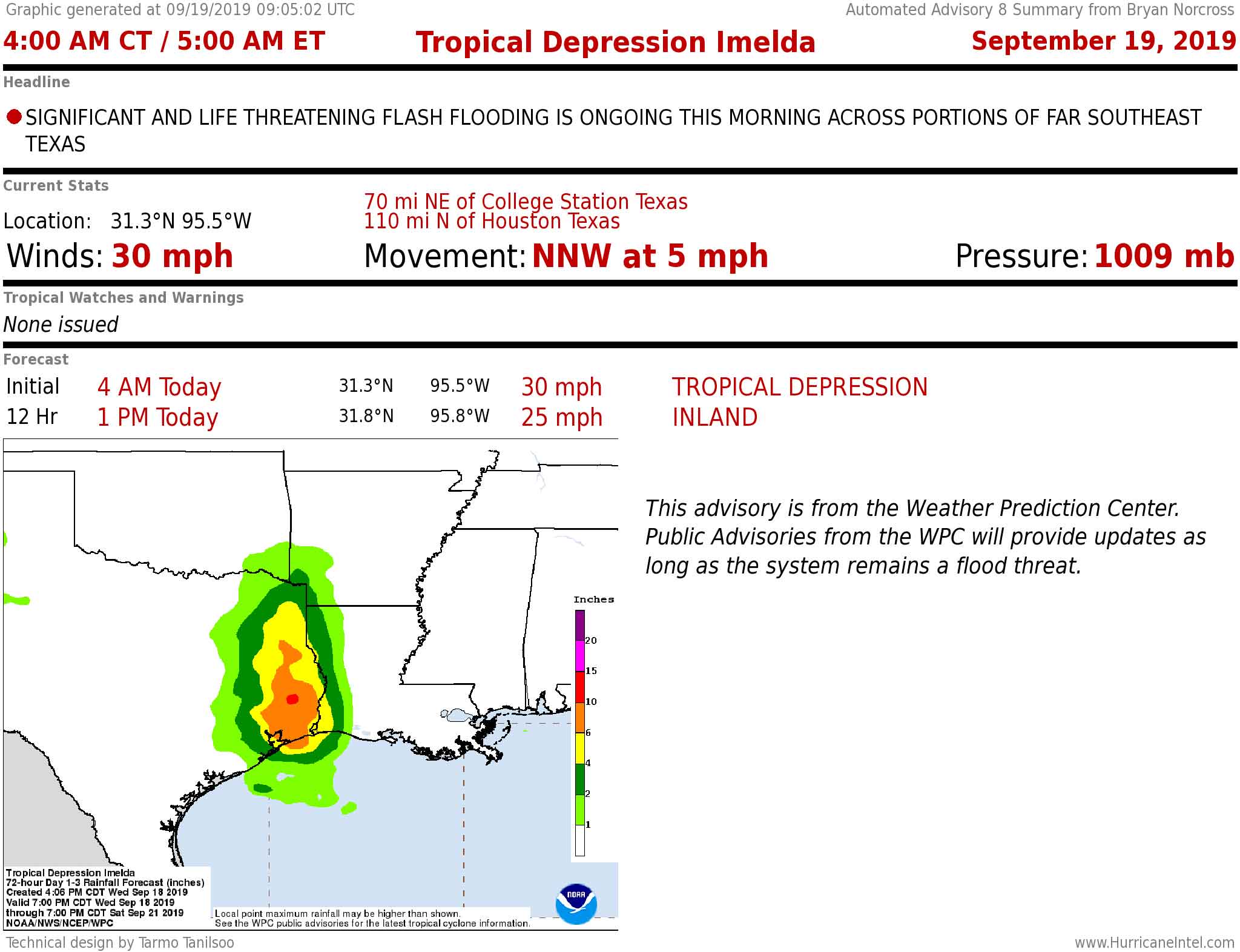
EX-IMELDA is still causing flooding rain, especially in the areas east of Houston. Some places have gotten over 2 feet of rain.
TROPICAL DISTURBANCE No. 1 is not expected to develop, but may bring dangerous heavy rain to Haiti and the Dominican Republic. The system is forecast to drift toward Jamaica and die out.
TROPICAL DISTURBANCE No. 2 will have to be watched late in the weekend or early next week when the computer forecast models say it will be in the vicinity of the southern Caribbean islands. It is not expected to organize much before then.
ELSEWHERE, the computer forecast models indicate that a disturbance will move off the African coast in the next couple of days that we will have to watch next week.