
Forecasters at Colorado State University – the pioneers of seasonal hurricane forecasting – issued their July outlook for the hurricane season, nudging down numbers from their April and June outlooks, but still calling for a slightly above average season overall.
The team of hurricane researchers predicts 16 named storms (including the three already observed), eight hurricanes, and three Category 3 or stronger hurricanes (winds of 111 mph or higher) in 2025. This is near but just above the 30-year hurricane season average of 14 named storms, seven hurricanes, and 3 Category 3 or stronger hurricanes.
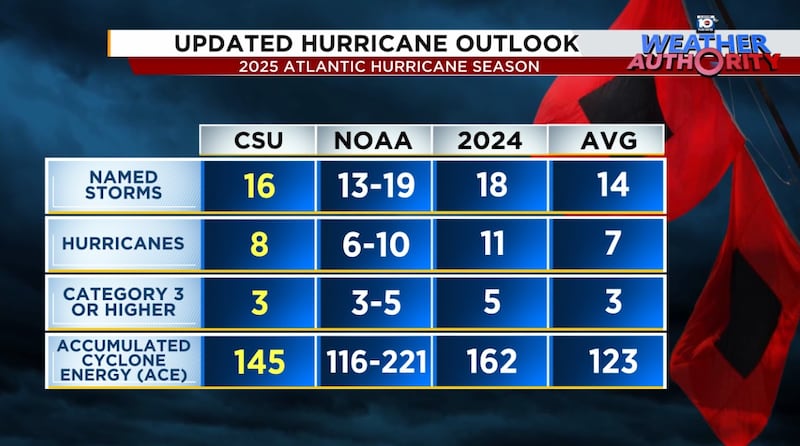
The CSU team also pared back predictions of a hyperactive season, dropping Accumulated Cyclone Energy or ACE numbers from 165 to 145.
The ACE score is the hurricane season’s grading scale, with higher numbers indicating stronger, longer lived storms.
On average, the seasonal ACE score is 123, with hyperactive seasons having ACE scores of 155 or higher. In 2024, Atlantic ACE was 162, making it a hyperactive season.
Hostile wind shear pumps the brakes
The main factor the CSU experts cite for their tick down in numbers is observed and predicted wind shear, much higher than average, especially in the bellwether Caribbean region.
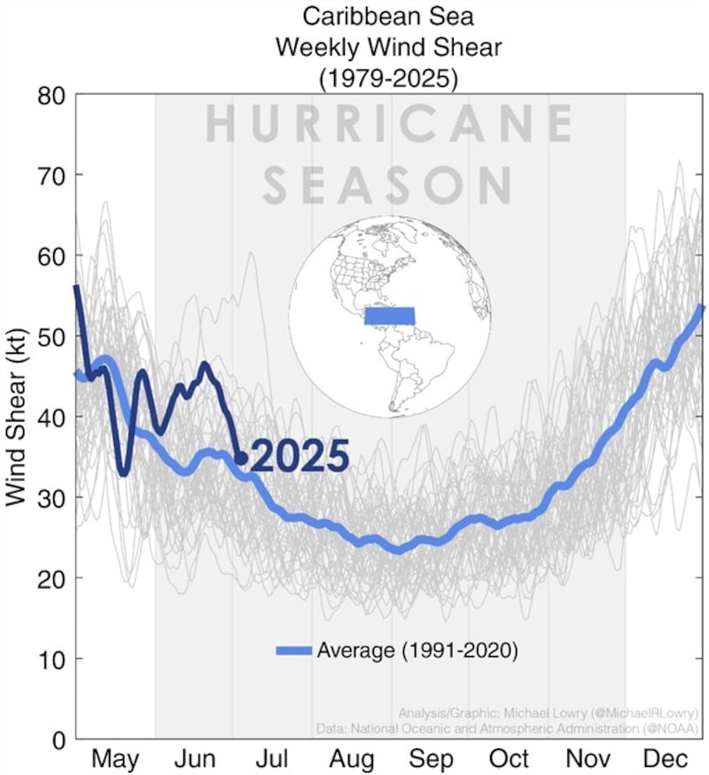

Their research shows that Caribbean wind shear has a negative relationship to overall Atlantic hurricane activity – that is when Caribbean wind shear is high, basin wide hurricane activity tends to be reduced.
An important caveat, however, is this relationship only holds from July onward. June shear in the Caribbean doesn’t count for much.

A wind shear reversal by August?
Though models show the shear sticking around for the next few weeks, they do show a noticeable reversal of upper-level winds, the primary driver of wind shear, come early August.

This change in upper-level wind pattern could be a byproduct of a strengthening Madden-Julian Oscillation or MJO, something we touched on in Tuesday’s newsletter, bringing enough vigor to the Atlantic to scour away at some of the less conducive conditions we’ve seen so far this season.
This is certainly one of the more significant signals we’ve seen yet in the Atlantic, so it’s worth following to see models start perking up as we turn the calendar to what’s traditionally the busiest stretch of the hurricane season.
Slow goings for now
Forecast models are lackluster for the next few weeks, with slow goings across the tropical belt of the Atlantic.
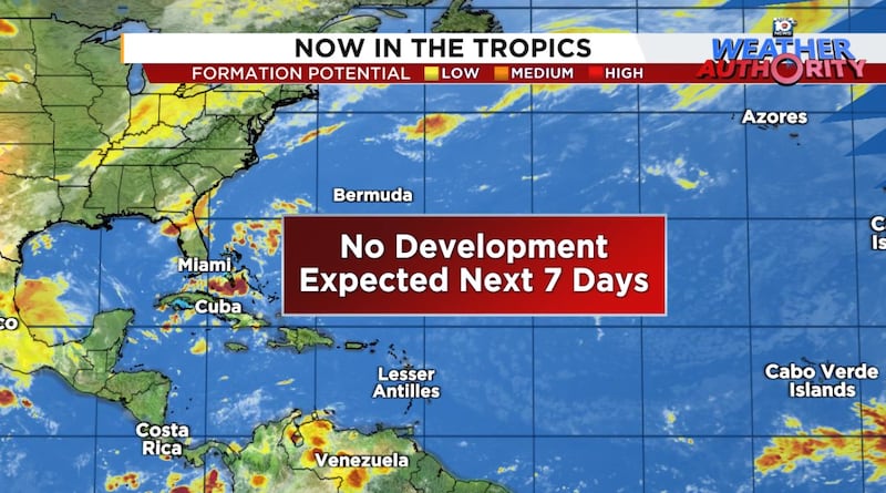
The only activity besides Barry we’ve seen so far in the Atlantic has come from outside the tropics, so we’ll keep an eye out for any suspicious areas along dying fronts. For now, we don’t see any concerning areas into at least the early part of next week.
CLICK HERE to download the Local 10 Weather Authority’s 2025 hurricane survival guide.
Copyright 2025 by WPLG Local10.com - All rights reserved.
