
An unusual and impactful late season storm developing north of the Dominican Republic and Puerto Rico – designated Invest 98L – will gradually organize over the next several days and slide westward toward Florida, bringing dangerous seas, widespread coastal flooding and beach erosion, gusty squalls, and the potential for heavy rain to a wide stretch of Florida’s Atlantic coast starting Tuesday into Wednesday.
Forecast models have trended toward a more organized subtropical or tropical storm approaching Florida by mid-week, though the verdict’s still out on how broad or consolidated the circulation will be. Regardless of the tropical technicalities, there’s increasing confidence for an impactful coastal storm affecting much of the Florida peninsula this week.
For us in South Florida, the worst weather looks to be on Wednesday into Thursday. Because we’ll be squeezed between high pressure to the north and the sprawling low pressure system to the south, deteriorating coastal conditions, including life-threatening rip currents, hazardous marine weather, large breaking waves, and minor to moderate coastal flooding will precede the storm system early this week. Just how much rain we see in South Florida from the storm will depend on how organized the system becomes and where its center tracks, but expect at minimum squally showers lasting into Thursday.
As we discussed in yesterday’s newsletter, this is an unusual system, not only because of how it’s forming, but also because of its approach from the east or even northeast during November. Since 1980, six tropical cyclones – four tropical storms and two tropical depressions – have struck the Florida peninsula in November, all initially from the south or west, and none with maximum sustained winds over 65 mph. Only one hurricane on record has struck the Florida peninsula in November, the so-called 1935 Yankee Hurricane, which made landfall near present-day Bal Harbor on Nov. 4 with 100 mph sustained winds.
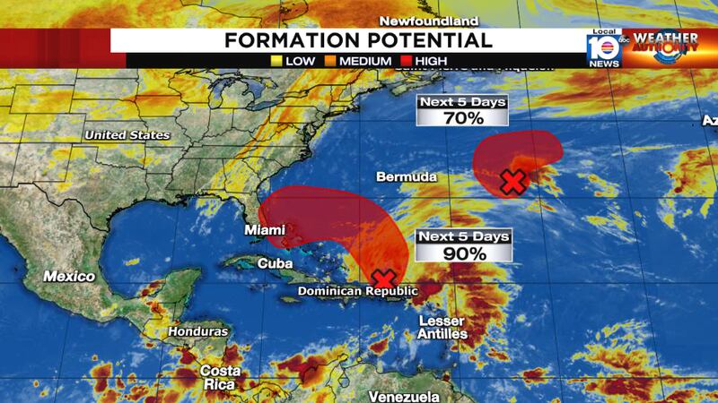
We’ll likely see a forecast cone from the NHC soon, but remember this will be a large weather system with wide-reaching impacts for the southeast U.S., so it will resemble more of a nor’easter than a tidy-looking tropical storm at first. If (and more likely when) the system becomes a subtropical or tropical storm, it would be named Nicole or Owen, depending on whether a short-lived tropical storm forms over the open north Atlantic first. The other low-pressure area, located some 700 miles east of Bermuda, poses no threat to land.
Copyright 2022 by WPLG Local10.com - All rights reserved.
